Viking Merseyside

allertonOak  
Last updated 1st February 2015
 
allertonOak home page
Introduction
Norse expeditions had started at the beginning of the 8th century, but they really took off after the unification of Norway in 872, when many nobles took issue with the King Harald I. A large number settled peacefully in the newly founded Viking kingdom of Dublin and some became Christianised by the native Irish. However they were expelled from Ireland beginning in 902 by Caerbhall, leader of the Leinster Irish, and continuing until 1014 with the Battle of Clontarf.
Many of the ex-Norwegians from Ireland settled finally on the Wirral peninsula (having being granted permission to do so by Edelfrida, daughter of Alfred the Great) and in the coastal regions of south-west Lancashire (less well documented but clear from placenames). This was poor quality land that was largely uninhabited at the time and hence undisputed by the locals.
There were many Danish Vikings as well, especially in Wirral, as witnessed by placenames ending in -by. The Danes originally settled in East Anglia from 865 but soon moved north to Northumbria. Analysis of placenames suggests a further migration to Cumbria and south-west Scotland and from there to join the Norwegians on the Isle of Man. It is thought that the Wirral Danes arrived in quantity from there.
A Viking coin
The old tower of St. Hilary's church in Wallasey
The Wirral Peninsula
One of the first things Scandinavian settlers approaching Wirral from the sea would have noticed would have been the wooden Saxon church of St. Hilary on the hilltop at Wallasey. They named the settlement Kirkby, later Kirkby in Walea, meaning the village with the church on the island of the Britons. The oldest relic on the site of St. Hilary's is the tower of 1530, all that was left standing after a disastrous fire in 1857.
Wallasey would have been almost an island at the time of the Viking settlements, cut off from the rest of Wirral by Wallasey Float and low-lying marshland. Nearby Moreton, a name of Anglo-Saxon origin, indicates a settlement on marshland. Wallasey's name suggests that it remained predominantly an Anglo-Saxon settlement. The higher ground would have been worth retaining by those already living there in contrast to the surrounding poor quality land, which was comparitively uninhabited. The name of the village of Liscard in Wallasey is Irish in origin and may be an example of Irish culture imported by the Vikings.
Just to the south of Wallasey is another area of high ground at Bidston. The name is Anglo-Saxon in origin (Byddi's farm), again indicating the preference of the native people for higher ground. The Vikings were happy to accept what they could get at the time, though they subsequently developed designs on Chester.
The ancient village of Noctorum, mentioned in the Domesday Book as Chenoterie, once lay on the Western slopes of Bidston Hill. The name is a Latinisation of the Old Irish cnocc tirim meaning dry hill, clearly referring to the contrast with the marshy land to the west. It seems to be another example of an Irish cultural import by the Vikings.
Many of the Vikings had become Christianised during their stay in Ireland. West Kirby, so named to distinguish it from the original name of Wallasey, was one of their settlements. The Christian church of St. Bridget was founded by them in the 10th century. It was named after St. Brigit of Kildare (c.451-525), one of Ireland's patron saints. The oldest parts of the present church are early 14th century.
St. Bridget's church in West Kirby
Bidston Hill
Dove Point in Meols
The long shore of the north coast of the Wirral peninsula provided good landing places for the vikings. Meols, whose name comes from the Old Norse for sandbanks or sandhills, was a major seaport and trading post for the Viking settlers. The coastline at Meols at this time reached significantly further out with a promontory at Dove Point that has been washed away. Major Viking archeological finds were made in the 19th century that were only revealed at exceptionally low tides.
Local tradition has it that the Leasowe shore was where King Canute had his famous altercation with the waves. On the sea-front near Leasowe Castle, there was once a so-called Canute Chair with the inscription 'Sea come not hither nor wet the sole of my foot'.
The Leasowe shore
Cross Hill in Thingwall
Thor's Stone in Thurstaston
 
Storeton Wood
Thingwall is Old Norse for assembly field and the small 205 ft (63 m) high hill now known as Cross Hill was a major meeting place or parliament for Viking communities from the entire northern half of the Wirral peninsula and possibly also from outlying areas at Helsby, Whitby and Talacre on the other side of the River Dee. In the 10th century, the area would have had complete political autonomy.
The author of the famous late 14th century poem Sir Gawain and the Green Knight was probably from Cheshire. The poem is rich in Scandinavian dialect words and indicates the importance of the Viking legacy even 500 years after the first settlers. Describing the region in Arthurian times (before the Vikings) the poet talks about '[...] the wilderness of Wirral. Few dwelt there that loved either God or man with a good heart'.
Nowhere in Wirral are Viking connections stronger in the mind of the general public than at Thurstaston, a name deriving from the Old Norse for Thorstein's farmstead. This is especially so at Thor's stone on Thurstaston Common. The origin and name of this isolated block of sandstone have been a target of much fevered romantic imagining, mainly by the Victorians. One such legend holds that is was man-made and used for sacrifices by the Vikings. The likely truth is more prosaic. It seems to have been carved out by water flows under the ice at the end of the last Ice Age and further modified by subsequent erosion and possible quarrying.
Storeton near Birkenhead, is old Norse for great farmstead or farmstead by a young wood. It is now thought possible that Storeton Wood and adjoining Bebington Heath (now Bromborough Golf Course) were the location of the important Battle of Brunanburh (Bromborough) in the year 937, though this is heavily disputed by some. In this battle, the English King Athelstan defeated an alliance of the remaining Dublin Vikings and Celtic Scots. Although some of the local Viking community were probably drawn into battle on the side of their Irish cousins, the event appears to have had relatively little long-term impact upon the Scandinavian culture of Wirral at that time. Both sides were considerably weakened by the bloody conflict and withdrew soon afterwards.
 
The Wheatsheaf in Raby
 
The original settlement of Raby goes back to Viking times. The name means boundary village as it was situated on the southern boundary of the Scandinavian enclave in Wirral. The boundary probably tracked the south and east edges of Tranmere, Storeton, Brimstage, Thornton Hough, Raby and Little Neston. Almost all of the Scandinavian placenames in Wirral lie in this area. The Wheatsheaf in Raby is probably the oldest surviving pub in the Wirral. It dates back to 1611 as a pub, but it seems that there was a smallholding here with a license to brew and sell beer as early as the 13th century.
Of the other Viking vilages in Wirral, the name Irby means settlement of the Irish and probably refers to Vikings from Ireland as opposed to the Danes in the surrounding area, who may have come mainly from the Isle of Man. The neighbouring settlements of Greasby (wooded stronghold) and Frankby (Franki's village or settlement) have names of Danish origin. Other placenames in Wirral with a Scandinavian origin are Arrowe (shieling or hill pasture), Claughton (hamlet on a hillock), Denhall (Danes' well), Gayton (goat farmstead), Hinderton (village lying at the back), Lingham (heather island on a marsh - a lost village on the Moreton shore), Ness (promontory - a lost feature of the coast), Neston (farmstead at the promontory), Tranmere (crane sandbank - not the type of crane to be seen there currently!), Whitby (white manor) and Woodchurch (church in a wood or a wooden church).
Further away on the south bank of the River Mersey, Helsby, aptly named from the Old Norse for village by the ledge, was an isolated pocket of Scandinavian settlement. Almost all of the settlements south of Wirral along the southern bank of the River Mersey have names that are Anglo-Saxon in origin.
 
Helsby Hill
The south-west Lancashire Mosses
South-West Lancashire
The south-west Lancashire mosses present a low lying, flat landscape of windswept trees and drainage ditches, peaceful and near deserted except for a rich backdrop of birdsong. When the Vikings settled here the land had not been drained. The area was largely uninhabited and regularly flooded by the River Alt.
The whole area is rich in placenames of Scandinavian origin: Ainsdale (Einulf's valley), Altcar (marshland by the River Alt), Argarmeols (Erengr's sandhills - partly where the Royal Birkdale golf course is now, but lost to the sea by the end of the 14th century), Birkdale (Birch-tree valley), Eggergarth (small ploughed enclosure - between Lydiate and Downholland Cross but now lost), Formby (Forni's village), Lunt (grove), Ravensmeols (Hrafn's sandhills - originally just south of Formby but washed away by the sea), Sefton (sedge farmstead, the plant indicating a marshy location)
The Crosbys, Little and Great, have a name coming from the Old Norse for village with crosses. It is thought that St. Mary's church in Little Crosby stands on the site of a Viking chapel called the Harkirk. In 1611, William Blundell, the local lord, established a burial ground here for Roman Catholic recusants denied burial at Sefton Church in the aftermath of the Reformation and unearthed a substantial hoard of Viking coins.
At Kirkby (yet another one!) there was a Saxon church when the Vikings arrived and named the village.
Wayside cross in Little Crosby
Aigburth Vale
There is another Thingwall in Liverpool, an ancient township that has now lost its identity, having been subsumed into Knotty Ash. Like its counterpart in Wirral, the small 175 ft (53 m) high hill on which the settlement was established was a major meeting place or parliament for the Viking communities of south-west Lancashire. Scandinavian culture became dominant in the area until the Norman conquest (even they were frenchified Vikings). The local language would have merged with that of the settlers, but would have had a predominantly Scandinavian character. The only current Scandinavian dialect word that I am aware of is the local gastronomic delicacy scouse, from a rather later generation of Norwegian sailors.
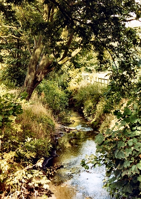
Croxteth is Viking in origin, meaning Krokr's landing place. Vikings are thought to have sailed up the River Alt and established a settlement here in the 10th century. Looking at the river now, it is hard to imagine Viking ships here, but up to a few hundred years ago, before the construction of flood gates near the estuary and the expansion of Liverpool depleted the water supply at both ends, it was a much more substantial waterway.
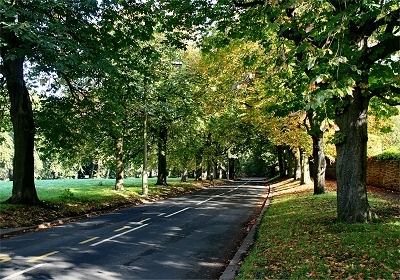
Finally, in the south of Liverpool, Aigburth is Old Norse for hill with oak trees (not inappropriate even today). The original settlement probably lay on the banks of the old Osklesbrok, on the slopes up towards Mossley Hill. Other names of Liverpool suburbs with a Viking Origin are Aintree (lone tree, possibly a landmark in an area noted for its lack of trees), Kirkdale (another church, this time in a valley), Litherland (sloping land, and it does), Roby (boundary village, cf. Raby in Wirral, on the boundary of the Scandiavian dominion) and West Derby (deer settlement - there still are some in Croxteth Park).
The River Alt at Croxteth Park
 
Acknowledgements and Further Reading
The image of the coin is from the BBC website Vikings. The photographs of Dove Point and Cross Hill are from Geograph, which grants permission to copy. My thanks to all of the authors. The essential reference book is Viking Mersey by Stephen Harding (2002).
Info
This site is the work of Laurence Scales and is part of allertonOak.
This is a non-commercial website that is intended entirely for research and educational purposes. If I have unintentionally breached copyright with any images, I hope that the copyright owner will tolerate my usage in the present context, otherwise I will remove the material.
The site is best viewed at a minimum of 1024x768 pixels resolution. The page layout will be optimal with your browser at about 1200 pixels wide.
Modern colour photographs on this site are by the author except where stated; you may copy these for non-commercial purposes only, but please place an acknowledgement to www.allertonoak.net at their point of use.