South Liverpool : Wavertree to Garston
Lost Rivers of Liverpool @ allertonOak  
 
Lost Rivers of Liverpool home page
allertonOak home page
The Lower and Upper Brooks, the Osklesbrok or River Jordan, and Otters Pool
The Brooks of Wavertree and Toxteth on the Yates and Perry Map of 1768 ...
... and on Sherriff's Map of 1823
The source of the Lower Brook at Wavertree Park
The Lower Brook Grotto in Sefton Park
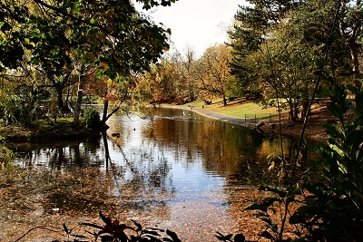
Two streams once traversed both Wavertree and Toxteth, the Lower and Upper Brooks, the lower reaches of which still survive in Sefton Park. Their present confluence is at the northern end of Sefton Park lake, which was formed by damming in about 1870 when the park was established.
The Lower Brook had its source at Wavertree Botanic Gardens (Wavertree Park). Two small ponds and a stream are shown on the current Ordnance Survey map close to the southern end of the old Littlewoods Pools building, but they seem to have dried up. The brook flowed in a southerly direction along the line of Spofforth Road and Webster Road to cross Smithdown Road (originally the ancient Smithdown Lane) and continue along the noticeable dip running across Toxteth Park Cemetery. It made its way onwards to the northern end of Sefton Park, where it makes its present day appearance. Here there is an artificial grotto, where the brook used to form cascades. It then makes its way peacefully down through the park to its confluence with the Upper Brook.
The Lower Brook in Sefton Park
The Old Brook House Inn
The course of the Upper Brook at Wavertree Playground
The Upper Brook had its source near the northern end of what became Wavertree Playground, flowing across the park down to Smithdown Lane to the east of the Brook House Inn of 1754 (demolished 1896) and west of the present Brook House (1878). The brook followed the line of Gorsebank Road into Greenbank Park (the first appearance of water nowadays). Here it was dammed to form a lake sometime before 1823. It flowed on through the Rathbone family estate, past their house Green Bank (see the c.1815 engraving), where there is now an elongated pond. It continued along the dip to the west of Liverpool College, crossing Ibbotson's Lane. A little further on, a trickle of water appears in a runnel that enters a culvert emerging at the eastern side of Sefton Park in a deep defile known as The Dell. On the northern bank is the Fairy Glen, a delightful piece of landscaping with rocks, waterfalls and a pool. Water is presumably pumped up from the brook to form this feature. From The Dell the brook flows on to join the Lower Brook at Sefton Park lake.
Greenbank Park Lake on the Upper Brook
The Upper Brook and Green Bank c.1815
The Upper Brook and Green Bank c.1900
The course of the Upper Brook at Ibbotson's Lane
The Upper Brook and The Dell
The Fairy Glen
The Upper Brook in Sefton Park
Sefton Park Lake
John Moss's Estate in 1810
The Old Mill at Otterspool
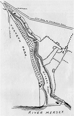
The meeting of the Lower and Upper Brooks formed the Osklesbrok, later known as the River Jordan by the local Puritan community. It once marked the southern boundary of King John's hunting domain Toxteth Park. The river was dammed in about 1870 to form a lake during the construction of Sefton Park.
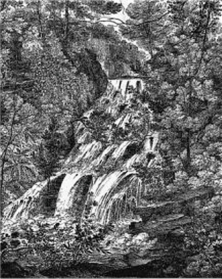
The river originally flowed across the route of modern Aigburth Road at Aigburth Vale (now a dip in the road with a culvert draining overflow from the lake) and into a deep ravine at the northern tip of the present Otterspool Park. This was once a most picturesque wooded valley, where the waters flowed through pools and a series of cascades at least until the 1820s. There was a dam called the Water-Lily Dam with a pool behind it. The river bed is nowadays essentially dry with a pleasant and peaceful surfaced path. Near the railway bridge and the site of the disused Otterspool Station stood the hunting lodge known as the Lower Lodge. Fragments of the Norman sandstone building have been found here.
The Osklesbrok emerged into the River Mersey at a large tidal inlet known as the Otters Pool, now a grassy hollow among trees behind the riverside embankment. This historic location may already have been in use as a fishery in Roman times; many Roman coins have bean found in the area. A few hundred years ago, all kinds of fish could be found here, including salmon, codling, whiting, fluke, sole and shrimps. The plentiful supply of food would have provided a perfect habitat for Otters. The name of the locality goes back to mediaeval times (Otirpul in the 13th century). By 1900 the fish had largely disappeared because of pollution.
Liverpool Corporation purchased the area from the Manor of Garston in 1779 and leased it to the snuff manufacturers Tate, Alexander and Wilson. They enclosed the mouth of the Otters Pool to make a dock with lock gates and built a snuff mill with workers' cottages.
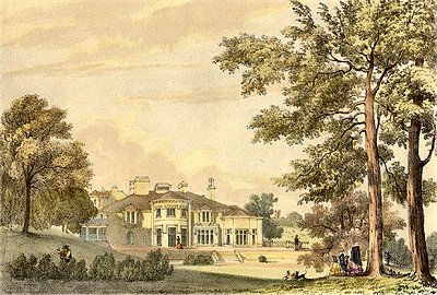
Around 1811 the estate was bought by timber merchant and banker John Moss, who built a mansion by the side of the pool and turned the snuff mill into an oil mill; boats landing coconuts were a frequent sight. He also had the carriageway constructed. The Garston and Liverpool Railway arrived in 1864 when Otterspool Station was opened. Liverpool Corporation bought the estate in 1925. The house then fell into a poor state and was demolished in 1931. Otterspool Park opened in 1950 and a café, now derelict, was built on the site of the house. Only the terrace and some landscaping from the original house survive. Otterspool Station was closed in 1951.
The present waterfront promenade has its origins in 1919 with the City Engineer's plan to enclose the foreshore from Garston Docks to the Dingle behind a massive river wall, to be filled in with waste. Construction of the wall took from 1930 to 1932 at a total cost of nearly £200,000. Most of Liverpool's domestic waste up to 1949, together with material from the excavation of the first Mersey tunnel, ended up here. The savings in comparison with the alternative, incineration, more than offset the combined construction and subsequent development costs. The resulting green spaces, paths and riverside promenade were opened to the public in 1950.
Waterfall on the Osklesbrok 1821
Otterspool House
Otterspool Station
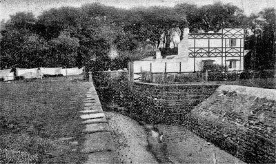
The Carriageway over the Osklesbrok
The Railway Bridge
The Remains of the Otters Pool
Solomon's Brook on the Yates and Perry Map ...
... and on Sherriff's Map
Solomon's Brook
Solomon's Brook, which has disappeared, was named after one Dr. Samuel Solomon, who lived in the neighbourhood around 1800. Its source was in the field behind Dovedale Road, from where it flowed south, past Mossley Hill Station (the dip in Rose Lane), to join and follow the path of present day Cooper Avenue. Around this junction point was a local beauty spot where a footpath called Solomon's Vaults, named after Dr. Solomon's mausoleum, ran alongside the stream. It eventually flowed into the Mersey at the present Garston Docks. It seems to have dried up before 1900.
Dr. Samuel Solomon made his fortune as a purveyor of a dubious medicines, notably the called the Cordial Balm of Gilead. He set up practice in Liverpool in the 1790s, selling his elixir that he claimed would cure, among other things, indigestion, hypocondria, intemperance, sexual debility, horrors of the mind and debauchery. It was probably no more than a blend of spices and strong brandy.
Solomon's Vaults by Charles R. Wood c.1910
The Brooks from Woolton and Hunts Cross on Sherriff's Map ...
The Brooks from Woolton and Hunts Cross to Garston
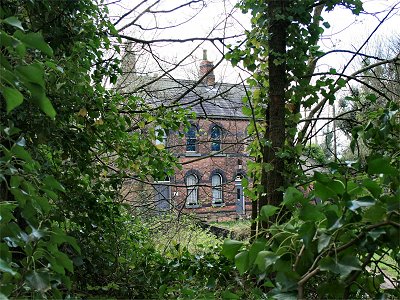
Two unnamed brooks rose in Woolton and Hunts Cross and had a confluence in Allerton. One had its source at the northern end of Vale Road and its presently mostly dry course can still be followed as a defile running from the opposite side of Menlove Avenue, across Allerton Tower Gardens and Clark Gardens, to Allerton Cemetery, from where it has been filled in (see the 1849 OS map on the right). It originally flowed down past Oak Farm (now on Springwood Avenue), where it joined the other brook, whose source was near the bottom of Hillfoot Road by the Hillfoot pub.
The combined stream flowed down to Garston past St. Michael's Church, just west of the line of Church Road and Dale Street (where there were a wooded section called The Dingle and a Dale House before 1900). It entered the Mersey at what is now the sourthernmost of the Garston Docks (once the Salt Dock) by the old Garston Salt Works.
The lower reaches of the river supported a number of dams, pools, mills and fisheries from mediaeval times. As early as 1264 the transfer of part of the Manor of Garston by Adam de Gerstan to the monks of Stanlawe in 1264 was recorded as involving:
  All the water which falls from Adam's Mill of Garston as far as the Mersey, and a plot of land for the building of a tannery or fulling mill upon the said water, whensoever they may see to be most expedient between this said mill and the Mersey, and of every kind of profit of the pool and easements of pool water [...] and also a fishery in the Township of Garston, called Lachegard, or mill pool.
The salt works, refining rock salt from Cheshire brought down the River Weaver, arrived in the 1790s. The area started to be filled in with the coming of the railways and the building of the first enclosed docks in the middle of the 19th century.
... and on the Ordnance Survey of 1849
Acknowledgements and Further Reading
As always, Mike Royden is the definitive writer on Merseyside local history and his Local History Pages: Otterspool provides a wealth of detail on this subject, some of which I have used here; I have also borrowed his drawing Waterfall on the Osklesbrok. The Garston and District Historical Society: Garston Industrial Development also provides detailed additional material. For much more on Dr. Solomon see the interesting article Dr. Solomon's Balm of Gilead by Colin Gould. The c.1815 engraving of The Upper Brook and Green Bank is from Nicholson's Views in the Vicinity of Liverpool by Samuel and George Nicholson (1821) and the c.1900 black and white photograph is from Mary Mary Quite Contrary by Melanie, with thanks. The drawing of the Old Brook House Inn is from A History of the Royal and Ancient Park of Toxteth by R. Griffiths, 1907. The view of Otterspool House is from Philip Mayer, with thanks.
This is a non-commercial website that is intended entirely for research and educational purposes. If I have unintentionally breached copyright with any images, I hope that the copyright owner will tolerate my usage in the present context, otherwise I will remove the material. Modern colour photographs are by the author.