 |
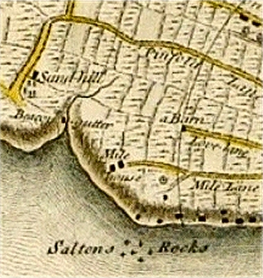
| Beacon
Gutter on the Yates and Perry Map of 1768 ... |
|
| Beacon Gutter |
| Beacon
Gutter once marked the boundary of the
Borough of Liverpool and Kirkdale (the latter was
incorporated in 1835). It entered the River
Mersey at a substantial inlet between Boundary
Street and Sandhills
Lane and there is still a kink in the Dock Road
that marks the spot. |
| To the north was the
village of Sandhills, once a pleasant area with a
house also called Beacon Gutter. This was the
retirement home of one Ellen Weeton in 1807. 'A
fine elegant sounding name, is it not?', she
wrote. 'Though only two miles from Liverpool
[... there are] few people passing or coming in.'
|
| The stream
presumably took its name from Everton Beacon,
a fire beacon that may
have dated back to the 13th century. It was
gutted by fire in 1782 and finally blew down in a
storm in 1803. Even so, the Yates and Perry map
shows only a rather short stream rising west of
Pinfold Lane (later Vauxhall Road). Even this
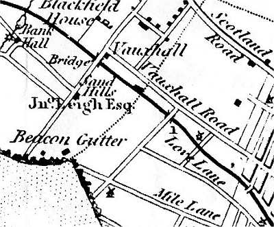
seems to have disappeared by the time of
Sherriff's map in 1823. |
| In 1838,
excavation of the gutter to build a sewer
unearthed the remains of an ancient oak forest.
This was thought to have stretched across the
Mersey estuary as far as Leasowe to the west and
Formby to the north, and to have survived
possibly as late as the post-Roman period. |
|
 |
| ...
and on Sherriff's Map of 1823 |
|