Central Liverpool
The Georgian Quarter, Cathedrals and Liverpool University
merseySights @ allertonOak  
Last updated 28th November 2016
allertonOak - home page
merseySights - home page
 
Walk: Liverpool Cathedrals and Georgian Quarter
 
In the text below, whole paragraphs in italic are quotations from original sources, as follows:
SOL   The Streets of Liverpool, James Stonehouse, 1869.
TDE   A Topographical Dictionary of England, Samuel Lewis, 1848.
The Georgian Quarter in Gage's map of 1836
The Georgian Quarter
Liverpool's Georgian Quarter consists broadly of the area bounded to the south by Upper Parliament Street, to the west by the Anglican Cathedral site and Rodney Street, to the north by Brownlow Hill and to the east by Grove Street. Systematic planning of housing in the area began at the start of the 19th century with the development of Moss Lake Fields into a grid of streets centred on Abercromby Square. This is the area at the top of Gage's map of 1836, to the right of the curve of Mount Pleasant. However it wasn't until about 1830 (incidentally the year of King George IV's death) that the buildings around the square were completed. By 1830 other areas such as Percy Street, Gambier Terrace and the Falkner Square district were being laid out and by the 1840s much of the housing in the Georgian Quarter had been completed.
Abercromby Square in 1831
 
The Georgian Quarter is well worth visiting, not just for the cathedrals but for its tranquil early 19th century elegance, dotted with cafés, restaurants and some of Liverpool's best pubs. It is still characterised by long terraces of quality town houses, which is fortunate because the whole district was under threat of demolition at one stage. In what follows, the area has been divided into three zones with Catherine Street and Hope Street as the dividing lines; each zone is covered from south to north.
Falkner Terrace
Upper Parliament Street
Huskisson Street (east)
Between Grove Street and Catharine Street
Upper Parliament Street was an extension of Parliament Street undertaken in 1807; the two marked the boundary between Liverpool and Toxteth Park. It has notably long and uniform terraces, that on the north side at the eastern end, the stuccoed Falkner Terrace, being the earliest. Dating from about 1831, it stood isolated for about 10 years.
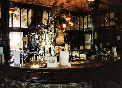
Peter Kavanagh's is one of Liverpool's most interesting pubs. The current building on Egerton Street, off Catherine Street, dates from the 1870s but was extended into the two adjoining houses in the 1970s. It was originally the Liver Inn, though I remember it in the late 1970s as the Grapes.
The eponymous Mr. Kavanagh ran the pub for 53 years from 1897 and was responsible for designing the amazing interior, with its carved oak fittings and furniture. There is a mass of bric-a-brac, and stained glass windows depict Liverpool's shipping and railway connections; the round tables with spill channels apparently came from liners. But the wall paintings by Eric Robertson, dating from 1929 and depicting subjects from Dickens and Hogarth, are perhaps the most distinctive feature.
Egerton Street itself is an unusual and charming street of two-storey terraces, with small, well-tended front gardens, dating from about 1844.
Huskisson Street has particularly fine terraces. Here at the eastern end they are brick-finished and later than the stuccoed houses at the western end. The street was named after MP William Huskisson. No.66 was the home of Alfred Rodewald (1862-1903), a cotton merchant and musician who founded the Liverpool Orchestral Society. He was a friend of composer Edward Elgar, who dedicated his Pomp and Circumstance March No.1, later set as Land of Hope and Glory, to him. The Rodewald Concert Society was founded in 1911 in his memory for the performance of chamber music and is still running under the auspices of the Royal Liverpool Philharmonic Society.
Peter Kavanagh's
The Back Room
Falkner Square (east)
Falkner Square (north)
Falkner Square (north west)
Falkner Square was named after Edward Falkner, soldier and Sheriff of Lancashire, who owned a lot of land in the area. Its stuccoed houses were mostly completed by the early 1830s and the park was one of the city's first open public spaces. However, it was unpopular at the time, being regarded as too far out of town (it was nicknamed Falkner's Folly), especially as regards the long uphill drag for horse-drawn vehicles, and stood isolated for years before the neighbouring streets were built up. Nowadays it is a lovely spot with mature trees, borders and grassy areas, and brings to mind squares in Georgian parts of London.
Canning Street, named after politician George Canning, is one of the longest and best-preserved residential streets in the Georgian Quarter. Heading down the eastern section from Falkner Square, the Anglican cathedral is seen to rise impressively over the houses.
Abercromby Square, named after soldier Ralph Abercromby, was the earliest residential area to be completed (about 1830). The east side, including the Greek temple styled St. Catharine's Church, was destroyed during World War II and the University now occupies all of the remaining buildings. The site of Abercromby Square and a large surrounding area was previously covered with an expanse of bog and water known as the Moss Lake.
Canning Street (east)
Abercromby Square (north)
Liverpool University Victoria Building
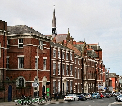
Liverpool University Victoria Building on Brownlow Hill was designed by Alfred Waterhouse and completed in 1892. It is the building responsible for the term Red-Brick University. It is suitably imposing both outside and inside, though the interior tiling has always reminded me of the older style of public convenience. It houses a café and the Victoria Gallery and Museum. It fronts a collection of fine red-brick buildings that contrasts sharply with a lot of rather dull later stuff and also some stylish new buildings.
The University College opened in 1882 with 45 students, compared with 32,000 today. In 1903, it received its charter and became the University of Liverpool. A carved stone block on the Victoria Building records that the college was established 'for the advancement of learning and ennoblement of life'. Well, your humble writer had the honour of contributing his bit, he hopes, as a member of staff longer ago than he cares to remember, and perhaps (still hoping) continues to do so with this site.
Catherine Street (south)
Huskisson Street (west)
Between Catharine Street and Hope Street
Catherine Street is the main thoroughfare through the Georgian Quarter and has many fine houses.
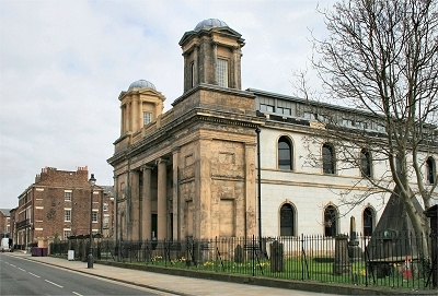
Huskisson Street at its western end has a fine stuccoed terrace and, on the corner with Percy Street, the beautiful neo-classical St. Bride's Church.
St. Bride's Church
Percy Street (east)
Percy Street is one of the finest in the Georgian residential area and the northern end was one of its earliest housing developments. The houses are quite distinct from those in neighbouring streets. At the north-east is probably the grandest block in the whole area, a huge symmetrical design with a Doric porch and colonnade and a balcony above. I can't be sure, but I seem to remember that Adrian Henri lived here for a time in the 1970s and used images of Georgian architecture in his poetry.
On the other side is a more restrained terrace in beautiful pink stone. I lived for a year or two in a flat here in the late 1970s. Most of the houses in the Georgian Quarter are now flats but my next-door neighbour's house was still in its original form. It was a memorable experience to see one of these lovely houses atmospherically done out in Victorian style, complete with his Pre-Raphaelite wife.
Percy Street (west)
Gambier Terrace (north)
Gambier Terrace (north) from the Anglican Cathedral
Gambier Terrace stands behind the Anglican Cathedral above the huge chasm of St. James's Cemetery. It was named after Admiral of the Fleet James Gambier. It runs the entire length of the cathedral but was built at different times and to different designs. The site was very desirable to potential residents because of the open views and the first stage at the north was one of the earliest of the new housing developments, construction starting in about 1830 and continuing until the early 1840s. It is another very grand symmetrical statement with a Doric porch, colonnades and balcony. The extension to the south dates from the 1870s and is also symmetrical but in a completely different style and built of yellow brick.
Gambier Terrace (south) with Percy Street and St. Bride's Church behind and Huskisson Street on the right.
Gambier Terrace (south) from the Anglican Cathedral
The Church of St. Philip Neri
Blackburne Terrace
St. Philip Neri is a Roman Catholic church on Catherine Street, designed by Matthew Honan in 1909 in a Byzantine style and opened in 1920. At its side is an attractive formal garden.
Blackburne Place is a characterful street. It sports the prominent, red-brick ventillation tower that once served the Edge Hill to Wapping railway tunnel, constructed in 1826-9. Rope-hauled wagons operated in the tunnel until the 1890s, when they were replaced by steam locomotives; the tower probably dates from then. Opposite is the elegant and early (1826) Blackburne Terrace.
At the Hope Street end is Blackburne House, built in about 1800 as a private residence for, and named after, the owner. It was turned into a girls' school in 1844, later the Liverpool Institute High School for Girls. The central tower, with a roof in the style of a French château, was added in 1874-6.
Blackburne Place
Blackburne House
Gambier Terrace (north) with Canning Street (west)
Canning Street: The western section continues the brick-faced style of the eastern part. It is sought after as a location for film sets for costume dramas, part of Liverpool's burgeoning movie industry. It is occasionally closed off, freed of cars and strewn with horse manure.
The Belvedere, hidden away in a cul-de-sac off Falkner Street, is a little gem of a pub. It has survived unspoiled with a tiny bar and a not much bigger lounge served through a hatch in the hall. In the lounge is a drawing of John Lennon by one of his colleagues when he was a student at the Art School.
The Belvedere
The Philharmonic Hall
The Philharmonic Hall is the second on this site at the corner of Hope Street and Myrtle Street. The earlier one of 1846-9 burned down in 1933 and the replacement opened in 1939. The rather plain exterior holds within a virtual museum of Art Deco designs. It is the home of the wonderful Liverpool Philharmonic Orchestra.
The Eye and Ear Infirmary on Myrtle Street is an eye-catching building in brilliant red brick, sandstone and terra cotta. Its style is influenced by old English architecture, with timber-framed gables and tall chimneys, but on a massive scale. It was designed by C.O. Ellison and built in 1878-80 and has now been converted to flats.
The Eye and Ear Infirmary
The Anglican Cathedral
The Oratory
Between Hope Street and Rodney Street
The Anglican Cathedral: The Cathedral completely dominates the southern end of this area. It is Britain's largest and the largest Anglican cathedral in the world, is so vast that it is hard to take in. Inside you are left marvelling that such a volume of space could be enclosed by a man-made structure and these impressions are not dulled by familiarity. The general effect is austere but overwhelming. The building is 619 ft (189 m) long and the tower is 331 ft (101 m) high. Access to the top of the tower is possible by a lift and many steps, the reward being sensational views over Liverpool and the surrounding country.
The architect was 22 year old Giles Gilbert Scott, whose 1901 design was said by the assessors to have 'that power combined with beauty which makes a great and noble building', but by 1909 he had completely revised it. The new design is more or less what we see now and represents the last great flowering of the Gothic Revival in England. It was largely built from local sandstone quarried at Woolton. Scott died in 1961 but work on the building was not finally completed until 1978, yielding 'one of the truly monumental buildings of our time' (Quentin Hughes).
St. James's Cemetery: There was a stone quarry here in the 16th century and quarrying continued until the stone was exhausted in 1825. It was laid out as a cemetery in 1826 by John Foster Junior, who was inspired by Père Lachaise Cemetery in Paris. It was closed as a cemetery in 1936 and left to fall into disrepair. Quentin Hughes writing in the 1960s called it 'one of the most powerful and picturesque spectacles in Liverpool, awe-inspiring in its mouldering decay'. It was opened as a public park in 1972 after most of the gravestones and monuments had been relocated around the periphery.
The gardens are now a green and pleasant retreat from the depths of which the Anglican Cathedral looks even more imposing. However, the entrance at the northern end is still quite creepy. A dark and narrow path descends through a deep cutting and tunnel in the smoke-blackened sandstone rock, lined with gravestones.
The Oratory: Next to the entrance to St. James's Park is the miniature Greek temple of the Oratory sitting on its acropolis. It was designed by John Foster Jr, inspired by his travels in Asia Minor, and dates from 1829. It once served as the chapel for the cemetery.
The Huskisson Mausoleum: Situated in the gardens is the Huskisson Mausoleum by John Foster Junior. It marks the grave of William Huskisson, Liverpool MP, who was killed by the locomotive Rocket on 15th September 1830, the opening day of the Liverpool and Manchester Railway.
  St. James' cemetery, the site of which was given by the corporation, is a large tract of ground originally excavated as a quarry for stone used in building the docks, and converted into a depository for the dead at an expense of £21,000; it contains 44,000 square yards, enclosed by a stone wall and handsome iron palisades, having four stately entrances. The interior is intersected by roads wide enough to admit a carriage, which lead to catacombs excavated in the rock. In the centre is an ornamental building containing a full-length statue of Mr. Huskisson. [TDE]
St. James's Cemetery and the Oratory c.1830
St. James's Gardens
The Huskisson Mausoleum
Hope Street and the Metropolitan Cathedral
Rodney Street and Mornington Terrace
Hope Street famously runs between the two cathedrals. It is named after William Hope, a merchant who lived in a house on the site of the Philharmonic Hall. It was straightened in the 1790s and residential development began in earnest around 1800. Today it is a vibrant street of hotels, restaurants and bars, along with the Philharmonic Hall and the Everyman Theatre.
Rodney Street contains some of the finest Georgian architecture in the city. It is known for its numerous doctors' practices and has been dubbed the Harley Street of the North. It was laid out by William Roscoe and others in 1783-4 and named after naval officer George Rodney. It was built in stages up to the 1820s by different architects, which accounts for the variety of frontages and roof-lines.
  Towards the close of the last [18th] century the district of Rodney Street, Upper Duke Street, and Hope Street was all unbuilt upon, being in some parts cultivated land, and in others growing nothing hut furze and heather. The fields, for instance, that skirted and overlooked the great quarry [...] were of this wild description. Along the site of these fields, Hope Street was cut to Parliament Street. Upper Duke Street terminated at the entrance of St. James's Road, on the south, and a few yards above Rodney Street, on the north. Just above this spot were a tavern, a windmill, and a bowling green [...]. This bowling green stood on the site of Mornington Terrace. Beyond this were fields, and as late as 1823 there were extensive roperies on the site of Canning-street. Just above Rodney Street was a little lane, which skirted the public house and the bowling green. This lane ran up eastwardly to a lane called Crabtree Lane, now Falkner Street [...].
  Rodney Street was projected about 1780. [...] In 1807 there were many portions of Rodney Street unbuilt upon, on which grew heather and furze about the sandpits abounding in the vicinity. The first house erected in it was by Mr. Pudsey Dawson, who had so benevolently and successfully taken the Blind School in hand. His house stood at the corner of or near Hardman Street, which was called after Mrs. Hardman, who had much land thereabout. Rodney Street has always been a favourite locality of the medical profession. There are at present upwards of twenty practitioners residing in it, either physicians or surgeons. [SOL]
Hope Street (south) and the Case History sculpture
Rodney Street (south)
Hope Street (north)
Mornington Terrace
The Liverpool Institute
William Ewart Gladstone's Birthplace
Mornington Terrace: Opposite the northern end of the Anglican Cathedral, Mornington Terrace on Upper Duke Street is a very attractive group of five red brick houses of c.1840.
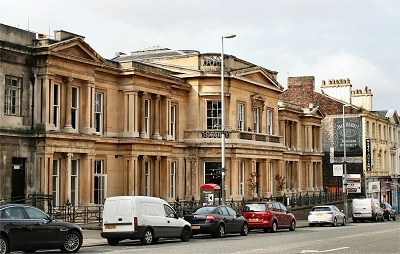
Liverpool Institute: Off Hope Street is Mount Street, where the Liverpool Institute is located, a plain but imposing building. This was built in 1835-7 as the Mechanics' Institution, providing classes for working men. By the 1850s a boys' school and an art school were evolving on the premises and in 1856 the name was changed to The Liverpool Institute and School of Arts. Under council control from 1905 until its closure in 1985, it was known as The Liverpool Institute High School for Boys. Among many famous pupils here were Beatles Paul McCartney and George Harrison. It rapidly fell into disrepair after its closure but was rescued by a team headed by McCartney and entrepreneur Mark Featherstone-Witty and reopened in 1996 as the Liverpool Institute for Performing Arts or LIPA.
Opposite the Institute on Mount Street, an attractive terrace of small town houses of c.1820 extends down the hill. At the top on Hope Street is a sculpture of 1998 by John King called A Case History representing a pile of luggage, with labels referring to local people and institutions.
William Ewart Gladstone's Birthplace: On the southern part of Rodney Street, No.62, built in 1792-3, was the birthplace of the famous Victorian politician William Ewart Gladstone.
Edward Chambré Hardman's House: On the other side of the road further down at No.59 is the house and studio of photographer Edward Chambré Hardman. This is now owned by the National Trust and can be visited. It has been restored to what it must have been like when he lived and worked there from 1947 to 1988. It houses his studio, darkroom and living quarters, together with an extensive collection of his photographs and equipment.
Ye Cracke is a characterful pub and a pub full of characters, at least it used to be when it was the haunt of John Lennon and the Liverpool Poets, and it still attracts one or two. Situated on Rice Steet, a narrow lane off Hope Street, it was built in 1852 as the Ruthin Castle, probably named after a ship. It was nicknamed Ye Cracke because of its size, and this had become its official name by 1892. It retains much of its no pretence, quirky style, with a tiny front bar and an even tinier snug known as the War Office (apparently because those who once wished to mull over the Boer War were banished there). There is also a large garish painting of a Napoleonic battle scene done in a primitive style. I seem to remember in the 1970s an original oil painting by 'Fifth Beatle' Stuart Sutcliffe hanging in the pub but it has long since disappeared - it would be far too valuable nowadays.
Mount Street
Edward Chambré Hardman's House
Ye Cracke
Pilgrim Street
The Philharmonic Dining Rooms
St Andrew's Church
Notre Dame Chapel
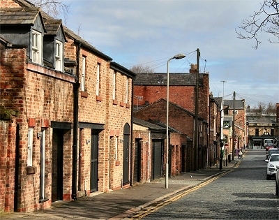
Pilgrim Street, a back street connecting Upper Duke Street to Hardman Street, has converted coach houses at the back of Rodney Street down one side that lend it a definite old world charm. One of the old buildings is now an interesting and atmospheric pub, the Pilgrim, the entrance to which is tucked away in a little alley down some steps.
The Old School for the Blind on Hardman Street was a new building of 1849-51 replacing an original that had to be demolished for the construction of Lime Street Station. It has recently been nicely refurbished as a restaurant and bar.
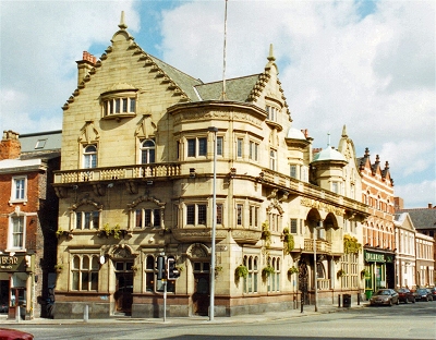
The Philharmonic Dining Rooms, probably Liverpool's most famous pub, was designed by Walter Thomas (who also designed the similarly grand Vines on Lime Street) for Robert Cain's brewery and was completed in 1900. The exterior (recently restored) is a kind of Scottish castle fantasy with magnificent art nouveau wrought iron gates.
Inside, there is loving attention to detail with ornate plasterwork, stained glass windows, glazed tiles and mosiac floors, with which the Liverpool University Schools of Art and Architecture were extensively involved. Accomodation is on the grand scale, the several large rooms lined with dark mahogany panelling and decorated with carving, the work of ships' carpenters who built the lavish interiors of the ocean-going liners of the time. The huge room at the back (the Grand Lounge) was once the billiards room.
Perhaps the pub's most celebrated feature is the gents' toilet, a somewhat dog-eared extravaganza in mosaic and marble (ladies may arrangement with the management). With an appropriate conflation of allusions to music and alcohol, two of the rooms are called Brahms and Liszt. One of these has an imitation minstrel gallery, while in the other is a fine stained glass window dedicated to music. The inscription reads 'Music is the universal language of mankind'. I'll drink to that.
St Andrew's Church, originally St. Andrew's Scotch Kirk of 1824, is located at the northern end of Rodney Street and now, after renovation, houses student accomodation. The original churchyard remains, featuring a strange pyramid of 1868, which is the tomb of railway magnate William Mackenzie, said to be buried in a seated position.
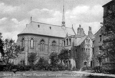
Notre Dame Convent evolved and expanded from the house at 96 Mount Pleasant beginning in 1851. It became the Notre Dame Collegiate School in 1902, a direct grant grammar school in 1946 and a girls' comprehensive school in 1983. It is now part of Liverpool John Moores University. The view from Mount Pleasant is rather flat and haphazard and the rear is now cluttered with more recent developments, but the c.1900 photo here shows the impressive chapel as it once looked.
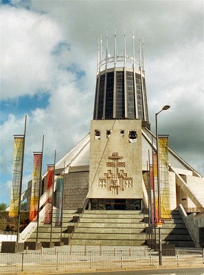
The northern end of Hope Street is completely dominated by Liverpool Metropolitan Cathedral, a magnificent counterpoise to the Anglican Cathedral at the southern end.
The Old School for the Blind
The Philharmonic Dining Rooms
Notre Dame Convent
The Metropolitan Cathedral
 
Acknowledgements and Further Reading
For excellent articles on Saint James's Cemetery and the Oratory see Mike Faulkner's Saint James's Cemetery. I have drawn on the indispensible Liverpool (Pevsner Architectural Guides), by Joseph Sharples, which has much more on the architecture. The engraving of Abercromby Square is by J. Starling after a picture by G. & C. Pyne and that of St. James Cemetery is by Fenner after a picture by T.M.Baynes, both published in Lancashire Illustrated, 1831, and sourced from the wonderful site Ancestry Images. The black and white photo of Notre Dame is from ronramstew. My thanks to both of the these. The aerial photos are my own and were taken from the top of the Anglican Cathedral tower.
This is a non-commercial website that is intended entirely for research and educational purposes. If I have unintentionally breached copyright with any images, I hope that the copyright owner will tolerate my usage in the present context, otherwise I will remove the material. Modern colour photographs are by the author.