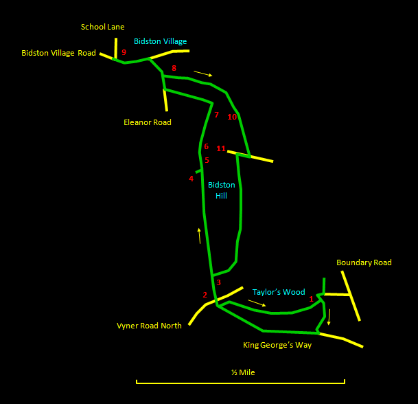
I've been meaning to do a walk based on Bidston Hill for quite a while and I'm glad I finally got round to it on a fine, crisp November morning. It's probably 20 years since I last visited the area and I'd forgotten how lovely it is. There are also great views and it oozes historical interest. So here we have a 2½ mile (4 km) stroll based on the Bidston Hill Heritage Trail as described in a leaflet put together by the Friends of Bidston Hill, available from the ranger's office at Tam O'Shanter Urban Farm. The route is mainly over clear paths that may be muddy and sandstone slabs that are usually horizontal but occasionally require a little care to avoid slipping or tripping. You should wear strong, waterproof shoes with a good grip.
The relevant
Ordnance Survey 1:25000 Explorer map is No. 266. For
further information on the locations visited, click on
the images.
 |
Detailed
mapping and satellite photography for this walk
courtesy of Bing Maps |
 |
Printer
friendly page for this walk (no photos) |
|


