Fiddler's Ferry to Pickering's Pasture
allertonOak  
Last updated 11th September 2007
 Home Page: merseyWalks       Home Page: allertonOak      

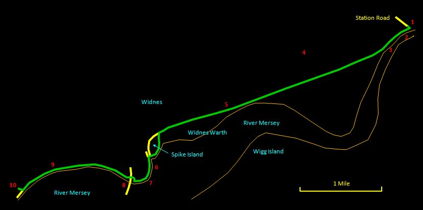
This 5½ mile (9 km) walk from Fiddler's Ferry to Pickering?s Pasture follows the Mersey Way (part of the Trans-Pennine Trail). It is a non-circular walk that you can follow in either direction, but you will need to arrange transport at each end. On the other hand, doubling back to the start makes an excellent and easy bike ride. The route presents you with a fascinating mix of isolated wilderness and monumental structures of the industrial age. It will be appreciated by those with a taste for its special character, who are happy to forgo mere prettiness for a kind of austere beauty. The way is entirely on paved surfaces and firm paths and any sensible shoes will do.

The relevant Ordnance Survey 1:25000 Explorer map is No. 275. For further information on the locations visited, click on the images.

Detailed mapping and satellite photography for this walk courtesy of Bing Maps
Printer friendly page for this walk (no photos)
CLICK ON THE IMAGES FOR MORE INFORMATION

Start at the entrance [1] to the Trans-Pennine Trail at the end of Station Road in Penketh. Cross the railway line carefully (this is an unsupervised crossing and the line is in use for freight). Then cross the bridge over the St. Helens canal. A sign points out the Trans-Pennine Trail - take the direction to the right. However, straight ahead and then right is the Fiddler's Ferry Tavern [2], a characterful place that is worth a visit, not least for its remote location on the marshes right by the River Mersey.

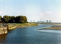
Heading down the main trail, you soon come to the yacht haven on the canal, where many boats are moored. The Mersey on your left is at its narrowest around here. The canal turns to reed beds as you approach Fiddler's Ferry power station [4]. This is an overwhelmingly vast structure and even close up it is difficult to get a sense of its scale.


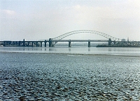
Keep on ahead until, around where the canal clears again [5], you get a distant view of the Runcorn bridges across Widnes Warth marshes. As you approach Spike Island, the Mersey Way follows a narrower path straight ahead. Take instead the broad path on the left. Along here you get a much better view of the power station and a clearer grasp of its size. The path eventually bends round to the right to reach the locks on the Mersey at the start of the St. Helens Canal. This is a pleasant spot with a variety of boats moored and hosts of swans and geese.


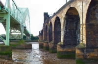
Follow the path along the riverside, where the old quayside walls [6] can be seen. It rises and joins the Victoria Promenade [7]. As you follow this round you suddenly see the Runcorn bridges close up in all their splendour. At the end of the promenade, follow the sign for the Trans-Pennine Trail through a few small streets to come out right under the bridges [8] - an impressive location. Keep straight ahead following the path by the river. It eventually starts to rise and unfortunately at one point you have to pass an industrial plant, hidden from sight but not, alas, from smell. Past this you are in the clear and soon reach the top of the hill, where there is a fine view over the river. Descend the hill via a zig-zag of shallow steps to cross the bridge over Ditton Brook [9]. A pleasant stretch along the riverside and you are soon at Pickering's Pasture with its nature reserve, visitor centre and car park. Glance back for a last view of the bridges.