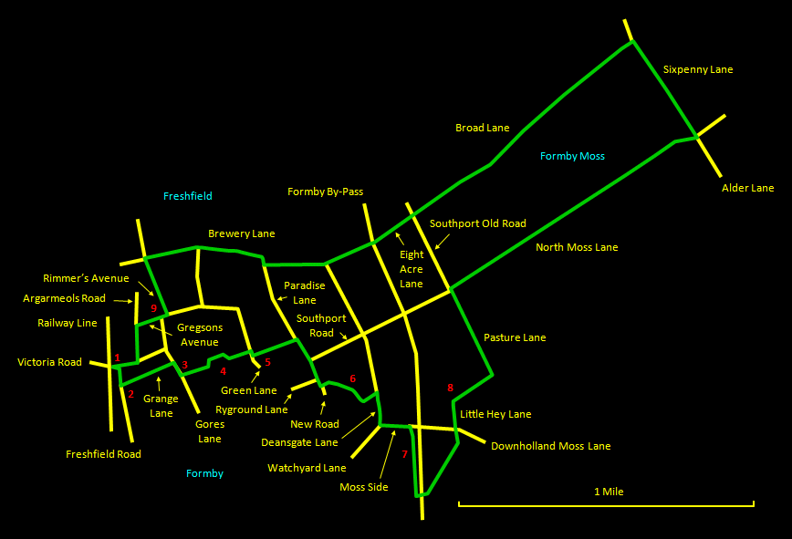
This walk of 6½ miles (10½ km) on level ground along suburban roads, country lanes and rural paths contrasts the older parts of Freshfield with the deserted open spaces of Formby Moss. It starts and finishes at Freshfield station. A shorter variant of 4½ miles (7½ km) is available that cuts out much of the Moss countryside. It starts with a leisurely amble through the quiet roads and byways of the older part of Freshfield, where you can see lovely old cottages and the fine Georgian St. Peter's church. It then heads out over the deserted fenland of Formby Moss, where peace and quiet are the order of the day. It returns by paths along the northern perimeter of Freshfield, finally taking in the excellent Freshfield Hotel, a good place for refreshments. The walk is based upon Walk 7 in the leaflet Walking and Cycling Guide to Sefton's Natural Coast issued by Sefton Council (availabel online). Much of the way is on hard surfaces, but the sections on unsurfaced paths can be very muddy after rain, so wear appropriate footwear.
The relevant
Ordnance Survey 1:25000 Explorer map is No. 285. For
further information on the locations visited, click on
the images.
 |
Detailed
mapping and satellite photography for this walk
courtesy of Bing Maps |
 |
Printer
friendly page for this walk (no photos) |
|
