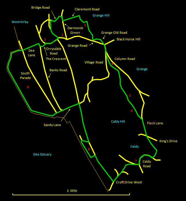
This fine and varied walk is about 4½ miles (7½ km) long. Although it is located entirely within the residential areas of West Kirby and Caldy, some of the time you could be forgiven for thinking you were in the heart of the countryside. It passes through the elevated heaths and woodland of Grange and Caldy Hills (superb views), the picturesque centre of old Caldy and along the coast (literally at sea level sometimes). For refreshments, the route passes nearby one of West Kirby's best pubs: the White Lion. There are also many good restaurants in the centre of West Kirby. Where you are on paths, these are clearly defined, though the walking is mixed, with occasional muddy patches and rocky slabs. Walking boots are recommended, therefore. Please note that at exceptionally high tides or in stormy conditions it is not safe to walk the sea wall of the marine lake at West Kirby. My thanks to Anne Bryson for help planning this route and for providing local information for the corresponding merseySights items.
The relevant
Ordnance Survey 1:25000 Explorer map is No. 266. For
further information on the locations visited, click on
the images.
 |
Detailed
mapping and satellite photography for this walk
courtesy of Bing Maps |
 |
Printer
friendly page for this walk (no photos) |
|
