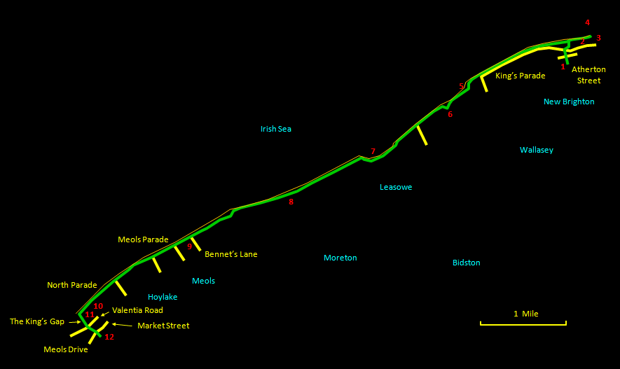
This is a walk of about 8 miles (13 km) along most of the north coast of the Wirral and taking in the Wirral Coastal Park. It is an extremely straightforward route, best taken at an exhilarating pace. Unless you prefer the sight of endless sand stretching into the blue (or grey) yonder, try and do it around high tide, when the sight and sound of the waves lapping at your side lend a pleasant hynotic ambience. The route can equally well be cycled. Non-masochist cyclists will want to keep to the sealed path running closest to the water, with only a few patches of soft sand necessitating a dismount. For walkers, there is the option in many places to take to grassy paths on slightly higher ground with somewhat broader views. The route starts at New Brighton Station and ends at Hoylake Station, from where you can catch the train back (changing at Birkenhead North). The length of the walk means paying some attention to what you wear on your feet.
The relevant
Ordnance Survey 1:25000 Explorer map is No. 266. For
further information on the locations visited, click on
the images.
 |
Detailed
mapping and satellite photography for this walk
courtesy of Bing Maps |
 |
Printer
friendly page for this walk (no photos) |
|
