Prehistoric Remains
A History of Allerton and Mossley Hill @ allertonOak  
 
A History of Allerton and Mossley Hill home page
allertonOak home page
The Mesolithic Period
Mesolithic peoples (8,000 - 4,500 BC) were the first inhabitants of the Merseyside area that we know of. Evidence of early inhabitants (about 5000 BC) has recently been discovered in the intertidal area of the Sefton Coast in the form of semi-fossilised human and animal footprints. These people were hunter gatherers, a nomadic existence that has left little in the way of remains. Nevertheless, flint artifacts from this period have been found near rivers in Croxteth (the River Alt), Speke (the River Mersey) and Tarbock (Ditton Brook).
The Neolithic Period
To its Neolithic inhabitants (4,500 - 2,500 BC), Allerton was an area of well-drained soils on top of sandstone and so relatively easy to clear of woodland. The lower lying land nearby was dense woodland, boulder clay, sandy areas and peat bogs. This would have made Allerton attractive to a people who had become farmers and tended to settle in one place. They left remains in Allerton itself in the shape of monuments such the Calderstones and the Robin Hood Stone. Axes for wood clearance have been found in Toxteth, West Derby, Gateacre and Wavertree, that, along with other archaeological evidence, confirm the importance of the area to them.
Allerton is particulary fortunate considering the extent of suburbanisation to have the remains of Neolithic monuments; these are very rare throughout Lancashire as a whole. The Calderstones are the most important of those surviving. Although now arranged as a stone circle in Calderstones Park, these stones are thought to be the remains of a nearby burial chamber, dating from the end of the Neolithic period, that was dismantled in the early 19th century. The grooved Robin Hood Stone has also been relocated and is now situated on Booker Avenue. It may once have been part of the same structure as the Calderstones.
The Bronze Age
The Bronze Age (2,500 - 700 BC) saw little change in the nature of the local economy. A Bronze Age burial ground and flint arrowheads have been discovered in Wavertree. Bronze Age axes were found in Knotty Ash in 1906 and Speke in 1946. The discovery of flint arrowheads in Wavetree and Childwall Woods and a flint scraper near the Calderstones, all dating from the Bronze Age, suggest that hunting was still widespread in these areas of higher ground, where woodland perhaps still dominated.
The Iron Age
The Iron Age (700 BC to the arrival of the Romans in 43 AD) was characterised by further settlement, organised field systems and villages acting as social hubs. The numerous hill forts in northern Cheshire date from this period. There is also thought to have been one at Camp Hill in Woolton, although its precise location is unknown.
The Calderstones
The Robin Hood Stone
1568 Map of parts of Allerton, Wavertree and Gateacre
 
Key:
1 The Calderstones
2 The Rogerstone
3 Pikelaw Hill
4 Pikelaw Hill: northern standing stone
5 Pikelaw Hill: western standing stone
Local Antiquities in the 16th Century
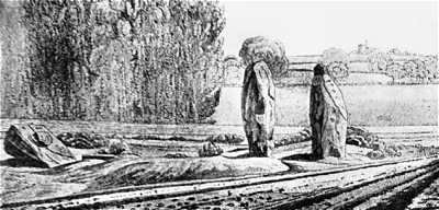
The Calderstones first appear in recorded history in connection with a township boundary dispute between the Molyneux family of Wavertree and the Lathom family of Allerton in the 1560s. In 1568 a survey was carried out by the Duchy of Lancaster and a map produced. On it are shown the positions of the Calderstones (also then known as the Caldway Stones, Dawger Stones and similar), a large mound called Pyckeloohill (possibly Pikelaw Hill) with two standing stones and a 'great stone' known as the Rodgerstone. The Calderstones were on a prominent site at a meeting of four lanes and were a recognised marker for the intersection of the townships of Gateacre (then Little Woolton), Allerton and Wavertree.
Although the map on the whole is not drawn to scale (Childwall Church is shown at the top), the area around these sites was surveyed in detail. Mike Royden (see below) estimates the location of Pikelaw Hill to have been somewhere between the house called Beechley on Harthill Road and the entrance to Calderstones Park on Allerton Road. This would place the Rogerstone close to the current location of the Calderstones in the Botanical Gardens vestibule.
The Robin Hood Stone is thought to have been part of the Calderstones group but it had already been removed by this time.
Estimated positions of the monuments (after Royden)
The Calderstones
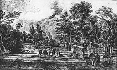
The burial chamber with its mound seems to have been fairly intact at the time of the 1568 survey. Just three stones are described as visible above the earth. The appearance was similar in 1700, when there was another boundary dispute. By about 1765, the mound had been disturbed and a number of urns removed. The Calderstones appear on the Yates and Perry map of 1768, but by 1800 the site had been partially destroyed, a process completed by about 1833, when Beech Lane was widened. The following entry in Baines's Directory of 1825 is interesting:
  Close by the farm on which the famous Allerton oak stands, and just at the point where four ways meet, are a quantity of remains called Calder stones [...]. From the circumstance that in digging about them urns made of the coarsest clay [and] containing human dust and bones have been discovered, there is reason to believe that they indicate an ancient burying place [...]. Some of the urns were dug up about sixty years ago, and were in the possession of Mr. Mercer of Allerton.
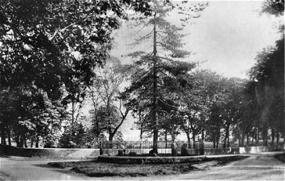
An engraving of the time shows the scene with Childwall Hall in the background (top right). In 1845 the resident of Calderstone House, Joseph Walker, was having his lodge and drive built and had the stones arranged in a circle and enclosed in a wall (still there at the junction of Calderstones Road and Menlove Avenue) with railings. It is thought that they had not been moved far from their original position as the surrounding network of roads is ancient. The arrangement of the stones was based upon the belief then current that they were the remains of a Druidical stone circle. John Peers, a local gardener recalled the early 1800s:
  [I] remembered the Calderstones well, before they were set up in their present position. The roads at that time were narrow country lanes. At this place there are four cross roads, and the stones lay upon a large mound at the roadside, high above the road, on [...] the south side. Only a few of the larger stones could be seen lying flat near the top, partly buried in the earth, and a few of the points of the other stones. Upon this mound, in the summer, after work, and on Sundays, the boys and men from the neighbouring farms would come and lie in the sun. [..] [I] well remembered the mound being destroyed. They were widening the road about the time it was done away with. When they dug down into it they found more of the stones, and the marked ones were among them. For some time the stones were laid aside on the farm, and afterwards some of the gentlemen of the neighbourhood had those now standing set up; others were taken away. Mr. Booker had the largest and set it up in his field, where it now is for the cattle to rub on. He thought that there were two more large stones. but did not remember what became of them. When the stones were dug down to, they seemed rather tumbled about in the mound. They looked as if they had been a little hut or cellar. Below the stones was found a large quantity of burnt bones, white and in small pieces. He thought there must have been a cart-load or two.
Mr. Booker's stone was probably not the Robin Hood Stone, tempting though that sounds. The Calderstones were left to the weather and industrial pollution on Walker's site until 1954, when Liverpool Corporation removed them for cleaning and restoration. In 1964 they were erected randomly in their present location in the Botanical Gardens vestibule in Calderstones Park.
There remain six irregular sandstone monoliths of different sizes with a variety of markings: spirals, concentric circles, arcs, cup marks, cup and ring marks and footprints. Several of these styles of carving are similar to examples found in burial chambers in Ireland and Anglesey, indicating the possibility of cultural influences spreading here from Ireland via North Wales about 4,000 years ago. Others markings may be graffiti from the last 200-500 years. Footprint marks are more unusual and perhaps indicate influences from Brittany and elsewhere. Because of their decorations, these stones may have been the walls of the burial chamber, the others having been appropriated by local people over the years.
The Calderstones in 1825 by William Lathom
The Calderstones c.1840
The Calderstones c.1900
Pikelaw Hill and the Rogerstone
The 1568 survey mentions a site called Pyckeloohill (possibly Pikelaw Hill) that was a large mound, probably much larger than the Calderstones burial chamber, flanked by two standing stones, one to the NNE and one to the WNW. The suffix -law indicates a burial mound and pike a pointed hill. In the 18th century the ground to the east of Harthill Road was known as Pikeley Hill. Harthill Road itself was then referred to as 'the road by Pikeley Hill to Childwall Church'. Slightly less than half of the way from Pikelaw Hill to the Calderstones stood another standing stone, the Rogerstone. Nothing remains of any of these monuments, despite several careful archaeological surveys over the years, and their precise locations remain unknown.
The Robin Hood Stone before 1928
The Robin Hood Stone
The sandstone pillar known as the Robin Hood Stone has deeply cut grooves suggestive of its use at one time for sharpening arrows. Needless to say, any connection with Robin Hood is pure fantasy. During the reign of Henry VIII every township had to make a field available for compulsory archery practice in case the local people needed to be called up to fight; stones were often used for sharpening arrows. It is thought that Booker's Fields, which lay between Booker Avenue and Greenhill Road, were once used in this way. The grooves in the stone, which are very deep, may, however, be natural.
The stone was located for centuries in a field known, at least as far back as a 1771 survey, as Stone Hey. It was moved to its present location on the corner of Archerfield Road (appropriately enough) and Booker Avenue in 1928 to make way for housing development. Its location had been on what is now the site of 11 Greenwood Road. The stone was excavated in 1910 and about a third of it was found to be under the ground. Similar markings were found on the newly exposed part to some of those on the Calderstones. This suggests that it was originally part of the burial chamber, although it might still have been a freestanding stone like the Rogerstone. In the 1568 survey of the Calderstones area, it was mentioned that a stone had been removed from the tumulus in about 1550.
Camp Hill
Camp Hill is situated just outside the boundary of Allerton in Woolton, but it is worth mentioning in the present context. A hill fort of the late Bronze Age or early Iron Age is thought to have been located here. It appears on the Yates and Perry map of 1768 as a circular enclosure. It may have been the northern outpost of the chain of hill forts stretching down through central Cheshire. The location is certainly appropriate, though very little evidence of its existence survives today. The site is thought to be around the Sunken Garden at the top of the path leading up from Hillfoot Road, although what might look like the remains of earthworks here can not be verified as such.
Looking over Allerton from Camp Hill
Sandstone pillar in Calderstones Park
Other Standing Stones
It may have been the rich prehistory of the Allerton area that has prompted the erection of two standing stones in Calderstones Park in more recent times. The Parks Development Officer, Nigel Sharp, has kindly provided me with some information about these.
Near the present location of the Calderstones stands a sandstone pillar that does possess a rather mysterious sculptural quality. Quarry workers' chisel marks give the game away and in fact it seems to have had a more prosaic use originally as a scratching post for cattle. It is sometimes erroneously called Jesse Hartley's Stone.
Jesse Hartley's Stone is, in fact, a rather less attractive notched shaft of granite, a sample provided for Jesse Hartley's Dock Engineer. The location was originally within the grounds of Harthill House and the pillar was erected by Hartley's daughter, Fanny, wife of John Bibby, as a monument to her father. It is quite difficult to spot in the hedgerow to the right of the vestibule that houses the Calderstones.
Jesse Hartley's Stone
 
Acknowledgements and Further Reading
I have drawn heavily on Mike Royden's detailed article The Calderstones at Mike Royden's Local History Pages. This is a strongly recommended read for anyone interested in the subject.
This is a non-commercial website that is intended entirely for research and educational purposes. If I have unintentionally breached copyright with any images, I hope that the copyright owner will tolerate my usage in the present context, otherwise I will remove the material. Modern colour photographs are by the author.