South Liverpool
Toxteth including the Dingle, St. Michaels and Otterspool
allertonOak  
Last updated 27th May 2017
allertonOak - home page
merseySights - home page
 
Walk: The Pier Head to Otterspool
Walk: Mossley Hill and Sefton Park
 
In the text below, whole paragraphs in italic are quotations from original sources, as follows:
LIV   Liverpool, Dixon Scott, 1907.
SOL   The Streets of Liverpool, James Stonehouse, 1869.
TDE   A Topographical Dictionary of England, Samuel Lewis, 1848.
VHL   The Victoria History of the County of Lancaster, ed. William Farrer and J Brownbill, 1907.
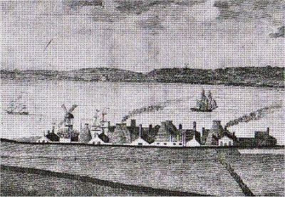
The South Shore in 1797
A Brief History of Toxteth
Toxteth is a large township, bounded by the City of Liverpool, Everton, Wavertree and Garston. At the time of the Norman Conquest (1066), Toxteth was part of the West Derby forest. The name appears in the Domesday Book of 1086 as Stochestede, Anglo-Saxon for stockaded place. The Domesday Book also records the village of Esmedune, later Smethedon and other variants, which only survived as the later Smithdown Lane.
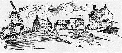
Park Road Windmill and St. James's Church
Toxteth on the Yates and Perry map of 1768
Toxteth on Sherriff's map of 1823
Mather's Dam and Cottages 1850
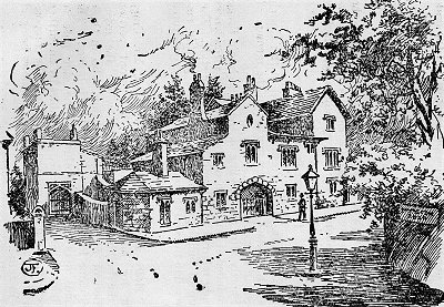
The Old Peacock Inn 1829
Knott's Hole in the 19th Century
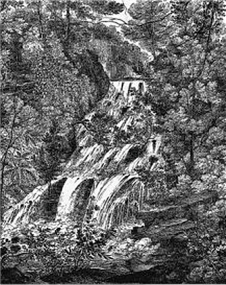
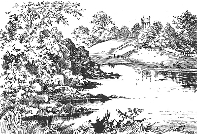
Waterfall on the Osklesbrok near Otters Pool
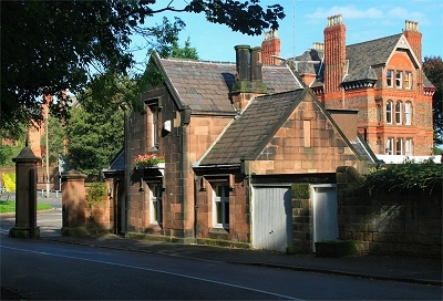
Fulwood Park Lodge
Prince's Park
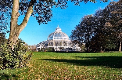
Sefton Park Palm House
The area became King John's hunting park in the early 13th century, when he established the Borough of Liverpool. It reached from the Pool of Liverpool to Otterspool: three miles along the waterfront and two miles inland. He took over Esmedune in exchange for Thingwall and the village subsequently disappeared.
Toxteth Park remained a private game park, completely rural in character, until 1604, when farming began. It was apparently never completely wooded and must have been very attractive countryside. Four streams traversed it: an unnamed brook from the Moss Lake, Dingle Brook, Dickenson's Dingle and the Osklesbrok.
King John erected two hunting lodges, the Higher Lodge at the junction of Lodge Lane and Ullet road (both ancient byways) and the Lower Lodge at Otterspool on the north bank of the Osklesbrok on the site of the disused Otterspool Station. The Higher Lodge was apparently built into the structure of the present-day Park Lodge.
Toxteth Park was granted to Sir Thomas Stanley in 1447 and to Henry Earl of Derby in 1593. It ceased to be a hunting park in 1591 and was disforested for farming by 1605, when it was transferred to Sir Richard Molyneux, to whose family the park had been leased since 1346.
The Ancient Chapel of Toxteth was built sometime between 1604 and 1618 on Park Lane. Richard Mather, a Puritan, was master of the local school. By 1635 he had fallen inexorably into conflict with the church authorities and set sail for Boston in the USA. Nearby was the celebrated Park Coffee House, later the Old Peacock Inn.
The area south of the modern Aigburth Road and west of Otterspool was settled by Puritans from about 1600 and was known as Jericho Farm. The land was donated by Sir Richard Molyneux, who was himself a Roman Catholic. The Lower Lodge was the birthplace in 1619 of the famous astronomer Jeremiah Horrox, who was taught by Richard Mather as a boy, and, among a number of discoveries, predicted and observed the transit of Venus in 1641.
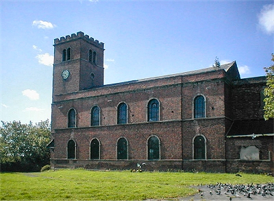
By the middle of the 18th century, Park Lane was the major route across Toxteth Park township, beginning at the Pool, where there was a ferry. In 1771 it was intended to develop the northern end of Toxteth as a new town to be called Harrington. A street plan was laid out but only St. James Church (completed 1775) was built. The turn of the eighteenth century brought instead the expansion of industry and docks to the south of Liverpool and with it the development of dense and insanitary courts and terraces.
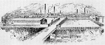
However, the southern part of Toxteth developed in quite a different way. The wealthy started to establish their villas near the shore here in what was evidently attractive countyside crossed by picturesque little streams. 1794 saw the opening of the famous Herculaneum Pottery Company near the Dingle on the site of a former copper works. The pottery went on to produce fine china but was dismantled in 1841. In 1810 the Mersey Steel and Iron Company opened The Mersey Forge, also known as the Toxteth Iron Works, adjacent to the pottery. John Cragg's iron framed St. Michael's Church and Hamlet appeared from 1815.
With the growth of the docks came the inevitable expansion of the population, the poorer people near the docks and the wealthy further inland, e.g., Fulwood Park (1840s) and along Prince's Road (laid out in 1846), near where beautiful parks were created.
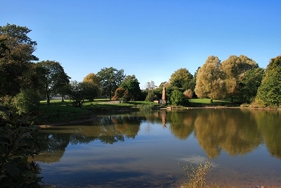
Prince's Park was the creation of iron merchant and philanthropist Richard Vaughan Yates. It was designed in 1842, slightly predating Birkenhead Park, but was not initially a public park; it later became Liverpool's first such. It established a model for the future of urban park design, separating vehicular and pedestrian traffic and providing water, landscaped meadow, wide views and winding paths. It was intended to be integrated with exclusive housing around the perimeter, the sale of which would provide for the park and its upkeep. The lake was formed by the damming of a brook that once flowed through Dickenson's Dingle, a valley leading down to the River Mersey at St Michael's.
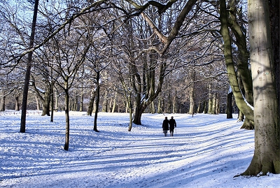
Liverpool City Council bought the land for Sefton Park in 1867 and the park was designed by Lewis Hornblower and Edouard André. At the time it was by far the largest public park in the country since Regent's Park in London. The finance model used for Prince's Park was adopted, whereby costs were to be recouped from the sale of plots around the perimeter for prestigious housing. The park is laid out like natural countryside rather than formal gardens, though with boulevards, curving drives and an artificial lake. It was opened to the public in 1872. The lake was formed by the damming the confluence of two streams, the Lower Brook and the Upper Brook. Between is the magnificent iron and glass Palm House of 1896, which houses a collection of exotic plants.
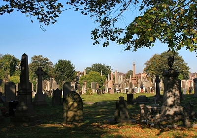
Toxteth Park Cemetery opened in 1856 to cope with the growing population. However, from the Dingle to the south, Toxteth remained gentrified and semi-rural until about 1900. The Liverpool Overhead Railway, with its terminus in the Dingle where the Cheshire Lines Railway already came in from the south, opened in 1893.
By the end of World War II, much of the 19th century housing that had survived bombing was declared unfit for habitation and a massive program of slum clearance began in the 1950s. Social problems did not disappear, however. Unemployment began to rise following the run-down of the docks and after a long period of racial tension between the black community and the police, the Toxteth Riots broke out in 1981. The Merseyside Development Corporation was formed in 1981 and began by redeveloping a former landfill site into the International Garden Festival in 1984. Since then Toxteth has been on the way up, though social problems remain. The waterfront has become a pleasant leisure area, the docks have been redeveloped for high-end apartments, marinas and businesses and extensive new housing areas have been built inland.
The Mersey Forge in 1907
The Herculaneum Pottery c.1806
Dickenson's Dingle and St. Michael's Church in 1820
John Cragg's House in St. Michael's Hamlet.
St. James's Church
Sefton Park
Toxteth Park Cemetery
The Toxteth Docks in 1909 - Northern Section
The Toxteth Docks in 1909 - Southern Section
The Keel
Queen's Graving Dock at the Keel
Brunswick Half-Tide Dock Entrance
The Cocklehole or South Ferry Basin
The Toxteth Docks
The docklands continued to expand to the south during the 19th century. Queen's Dock, which opened in 1796, was originally within the Borough of Liverpool, but was extended into Toxteth in 1816 and rebuilt for steamships in the early years of the 20th century. It is now a large but relatively featureless expanse of water, dominated by The Keel of 1993, the Customs and Excise offices and the last in a long line of customs houses on the docks. The Keel was built over and incorporates the old Queen's Graving Dock.
Brunswick Dock, Jesse Hartley's first, opened in 1832 and was initially used for importing timber. It was accessed from the river by two locks, the narrower of which is still in use while the other has been blocked. It was bebuilt and extended to the south in 1905 and is now used as a marina, surrounded by modern apartment blocks. It is the most southerly of the surviving docks. Also in this area was Brunswick Half-Tide Dock, now filled in but whose entrance, complete with two octagonal gatemen's shelters, survives.
Coburg Dock opened in 1840 as a grain terminal (the large grain silo was only demolished in 1986) and was developed from the former Brunswick Basin. It had a wide entrance to the river that is was sealed up by 1909. It was enlarged inland in 1858, consuming the Union Half-Tide Dock and providing connections to Queen's Dock and Brunswick Dock. A surviving remnant of the pre-Coburg docks, just to the south of the present-day dock, is the South Ferry Basin of c.1820, also known as the Cocklehole, built for the use of fishermen and ferries.
Next came Toxteth Dock in 1842, enlarged in the 1880s, which became home to the Harrison Line. It was linked to Brunswick Dock and via a lock to the river. It was filled in in the 1970s but the former transit shed with its clocktower and the Century Building survive on Sefton Street. Egerton Dock was a small dock built for river and canal boats moving timber in 1839.
Two further slightly larger docks, Harrington Dock and Harrington Dry Basin, were built just to the north by Jesse Hartley and opened in 1844. All of these docks were merged and greatly extended to form the final Harrington Dock, opened 1882, linked to Toxteth Dock and with a lock to the river. Like Toxteth Dock, it was filled in in the 1970s and the whole area is now occupied by Brunswick Business Park and apartment blocks.
  On the south of the Union dock is a dock of greater dimensions than any of the preceding, named the Brunswick dock, which is peculiarly fitted for vessels laden with timber, having a half-tide basin on the west. It is also furnished with two spacious graving docks, into which vessels can enter at any state of the tide; each graving dock is capable of containing three large ships. To the south of the Brunswick dock, which was completed in 1832, is the Toxteth dock, chiefly used by vessels with cargoes of mahogany: this small dock, and the land for 600 yards further to the south, including the new Harrington docks, are proposed to be formed into a dock for the further accommodation of the timber trade, under an act obtained in the year 1846. [TDE]
The last of the docks was Herculaneum Dock, which opened in 1866. The site had been a tidal basin of 1767 serving a local copper smelting works. From 1794 to 1841 it was the site of the famous pottery. The new dock, with two graving docks, had two wide locks to the river separated by an island. Further graving docks were added in 1876 and 1902 and a branch dock in 1881. From 1873 the dock handled petroleum and special storage facilities were built in the sandstone cliffs behind. The lock area survives and there is a Chinese restaurant on the former island, although the rest of the site was filled in in the 1980s.
Queen's Branch Dock No. 1
Brunswick Dock West Lock
Brunswick Dock East Lock
Coburg Dock
The Century Building
Herculaneum Dock West Lock
Herculaneum Dock East Lock
A Toxteth Timeline: This timeline has been adapted from that given by Griffiths, see Acknowledgements and Further Reading below.
1204   The Manor of Smethom laid waste by King John. Toxteth Park formed.
1346   Park let at £17 per annum to the Molyneux family.
1359   License by Duke of Lancaster to William de Liverpool to take two cartloads of "gorstorum" [gorse] weekly from Toxteth Park for 12 pence per annum. Pardon by the Duke for a trespass done in the park by William Cobynson and others.
1360   Roger de Ditton appointed Keeper of Toxteth Park for life with same wages as late Keeper, Roger de Mourton, and the grant of a certain rock within the sea called "Skery-orde" to construct a fishery there.
1447   Toxteth Park granted to Sir Thomas Stanley.
1591   Toxteth Park disparked.
1593   Toxteth Park granted to Henry Earl of Derby.
1596   Disforestation begins.
1605   Toxteth Park conveyed to Sir Richard Molyneux.
1615   Old Peacock Inn supposed to have been built.
1618   Ancient Chapel of Toxteth completed.
1619   Jeremiah Horrox, astronomer, born in the Lower Lodge.
1635   Rev. Richard Mather sails for America.
1643   Cromwell quarters his Ironsides in the Ancient Chapel.
1645   The inhabitants [of Liverpool] allowed by the Parliament to take timber from Toxteth Park for their losses during the siege.
1650   Lord Molyneux erects two water mills in Toxteth Park.
1670   About this period Lord Molyneux diverts a stream from the Moss Lake to feed his water mills.
1754   Old Brook House built; pulled down 1890.
1770   First farm broken up for building land.
1775   Town of Harrington founded by Earl of Sefton.
1794   Herculaneum Pottery started; taken down 1841.
1810   Mersey Forge founded.
1815   St. Michael's Church completed.
1826   Harrington Waterworks established.
1835   Toxteth Park declared extra-parochial.
1840   Fulwood Park laid out.
1843   Princes Park presented to the town.
1845   Iron tank at Liverpool and Harrington Waterworks bursts on Christmas Day; district flooded; 6 lives lost.
1856   Smithdown Road Cemetery consecrated by Bishop of Chester, June 9. Cost £226,000.
1858   Toxteth Park Workhouse foundation stone laid by H. Horsfall esq., Oct. 21st.
1863   Lower Lodge pulled down during construction of Garston and Liverpool Railway.
1867   Land for Sefton Park purchased
1869   Omnibus Tramway from Town Hall to Dingle opened Nov. 1st.
1893   Formal opening of the Electric Overhead Railway by the Marquis of Salisbury, Feb. 4th.
1895   Toxteth Park included in the City boundaries Nov. 9th.
1898   Work of experimental electric tramway from Gt. George St. Church to the Dingle commenced July 22nd.
1901   Fire at the Dingle Tunnel, Overhead Electric Railway, six people being burnt to death, Dec. 23rd.
1902   Toxteth Branch Library erected at a cost of over £12,000; formally opened by Mr. Andrew Carnegie, Oct. 15th. City boundary extended by the absorption of Garston, Nov. 8th.
1911   Sefton Park Lending Library given and opened by Dr. A. Carnegie Aug. 3rd.
The Church of St. Michael's in the Hamlet ...
... the interior and east window ...
... and the graveyard
St. Michael's Hamlet
St. Michael's Hamlet is a quiet enclave and a remarkable step into the past. It is notable in particular for its collection of cast iron framed buildings built by John Cragg (1767-1854). Cragg made his money as the owner of the Mersey Iron Foundry in Tithebarn Street, Liverpool, and was keen to exploit his business in the construction of churches. He was a founder member of the Liverpool Athenaeum, a gentleman's club, where he probably met the architect Thomas Rickman (1776-1841). Rickman was self-taught as an architect, but became an authority on Gothic architecture (he is credited with introducing the term perpendicular in this context) and was a key figure in the Gothic revival in church design in the 19th century.
Cragg planned to build his first church in Toxteth at his own expense, partly to exploit his iron foundry. He bought a plot of land in Toxteth Park from the Earl of Sefton in a beauty spot (see the picture above) known as Dickenson's Dingle. He had preliminary plans drawn up by Joseph Gandy but the main design was completed by Rickman.
Cragg was by all accounts a difficult character who was at odds with the more conciliatory Rickman throughout their collaboration, constantly plagiarising his work and interfering with his designs. Cragg took out patents for the unique cast iron mouldings to be used in 1809 and 1813. In the event, the opportunity to build St. George's Church in Everton arose first, but before that church was complete he had already started on the Church of St. Michael in the Hamlet, which was completed in 1815.
Here Cragg felt at liberty to make much more widespread use of cast iron frames than in Everton, not only for supporting structures and windows but also for external walls. His idea, a prescient one as it proved to be, was that stonework could be replaced and extensions built with minimum disturbance to the existing structure. The parapets and pinnacles are made of cast iron too, sand-blasted to look like stone. St. Michael's became known locally as the Cast Iron Church. It is an early example of mass-production in building, as many of the moulds for the frame of St. George's Church in Everton were re-used here and casts were subsequently shipped around the world, also handy as ballast on the outgoing merchant ships. A third church, St. Philip's on Harman Street in Liverpool, was also built but has been demolished.
Cragg built several houses near the church featuring extensive structural and decorative use of cast iron. The area became known as St. Michael's Hamlet and has been called 'virtually a museum of early 19th century cast iron architecture' (Quentin Hughes). Carfax, originally The Nunnery, is one of five of these 'Cast Iron Houses'. The name comes from the French Carrefour for crossroads, presumably because of where it is situated. The others are Holly Bank (originally Abbotsfield and occupied by Cragg himself from 1835 to 1841), The Hermitage, The Cloisters and, towards the river, Priory House.
Abbotsfield had stables that Cragg allowed worshippers to use. Priory House seems to have burned down in the 1930s, but the name lives on as Priory Wood; the position of the house is still clear. Next door stood The Grange, birthplace of jazz singer, writer and art critic George Melly (1926-2007). The central castellated part of Glebelands was built at the same time as Cragg's houses for use as a vicarage.
The Mersey Steel and Iron Works and an iron ship building yard once stood nearby next to the site of the old Herculaneum Pottery (as shown on the 1848 map). This is probably the reason why the stretch of the Mersey shore near the Dingle was once known evocatively as the Cast Iron Shore (the Cazzy to scousers).
John Cragg's House Abbotsfield
The Priory
Carfax
Glebelands
The Priory and the Grange at St. Michael's c.1830
The Marina at Coburg Dock
Spring Tide near the Festival Park
The Mersey at Otterspool
The Waterfront
The waterfront was a reknowned area for fishing from the earliest records up to the onset of the Industrial Revolution, when pollution began to rise.
  The fisheries of the Mersey were at one period of considerable importance. In Doomsday [sic.] Book it is stated that the King's tenants in Lancashire were bound 'to attend to the King's huntings and fisheries'. In all the ancient leases relating to the town of Liverpool, the fisheries are mentioned. [...] About the middle of the last [18th] century, so plentiful was salmon in the Mersey, that it could not be consumed in the neighbourhood, and was obliged to be sent away elsewhere to be sold. One local historian states that there were in his time upwards of forty-five different species of fish to be found in the Mersey, from the lordly sturgeon to the humble dab or flounder. [...] At one time there were extensive curing houses in Wallasey, and several in Liverpool, and fish yards as they were called were established on the banks of the river at Garston. [...] The disturbance of the Mersey waters by the innumerable steamships and vessels constantly present on their surface, their pollution by the Manchester dyeworks, the sewage of the places they pass, and the reckless and improvident conduct of the fishermen themselves, have all conduced to destroy the finny tribes that once made these waters their habitation. [SOL]
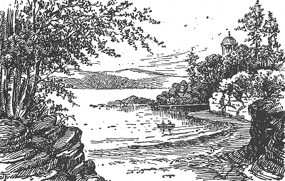
The shoreline featured several rocky inlets - Knott's Hole, Dickenson's Dingle and Otters Pool - that became attractive to visitors following the opening up of Toxteth Park. From the 18th century they also drew the wealthy to build their villas here. Dickenson's Dingle was named after John Dickenson, who had a house known as the Tall House on the nearby shore in the later 18th century. When the new town of Harrington was being planned in the 1770s, so was a ferry across to Birkenhead. The Tall House and a landing stage were built, the former being a tavern. The scheme met its demise with that of Harrington and the building was eventually demolished in 1844, although there was eventually a ferry service from near here to New Ferry.
The gradual southward extension of the docks from 1796 to 1886 brought about an inevitable change to the northern part of the shore, though the southern part remained relatively unscathed until the early 1900s.
After World War II, increasing containerisation brought about the gradual demise of the south docks as a commercial port area. A promenade was built at the water's edge from the Pier Hear to Garston. This had its origins in 1919 with the City Engineer's plan to enclose the foreshore from Garston Docks to the Dingle behind a massive river wall, to be filled in with waste. Construction of the wall took from 1930 to 1932 at a total cost of nearly £200,000. Most of Liverpool's domestic waste up to 1949, together with material from the excavation of the first Mersey tunnel and bomb damage rubble, ended up here. Unfortunately the pretty inlets were lost. The savings in comparison with the alternative, incineration, more than offset the combined construction and subsequent development costs. The resulting green spaces, paths and riverside promenade were opened to the public in 1950.
In 1984 a landfill site was converted into the International Garden Festival, which closed in 1996. It is currently being redeveloped as a park and housing. The docks were gradually redeveloped as apartments, marinas and businesses and the remainder of the promenade to the Pier Head was completed as the Mersey Way.
The Tall House c.1800
 
Stormy Weather near the Dingle
The Ancient Chapel of Toxteth
Ullet Road Unitarian Church
The Greek Orthodox Church of St. Nicholas
The Synagogue ...
... and its original design pre-1961
Religious Buildings
Toxteth boasts quite a number of architecturally important religious buildings, four of them Grade I Listed. Among these, the oldest is the Ancient Chapel of Toxteth of c.1604-1618. It was always associated with non-conformist religion and became a presbyterian meeting-house in 1672.
The remaining Grade I Listed churches are all in the Ullet Road Area. The Church of St. Agnes and St. Pancras opened in 1835. The Pevsner Guide calls it 'by far the most beautiful Victorian church of Liverpool [...] an epitome of Late Victorian nobility in church design'. Ullet Road Unitarian Church opened in 1899. Together with the church hall and cloister, it forms 'one of the most elaborate non-conformist ensembles in the country' (National Heritage). St. Clare's Church opened in 1890. It is described in the Pevsner Guide as 'one of the most imaginative churches of its date in the country'.
Finally, there is the cluster of religious buildings at the northern end of Prince's Road. The Greek Orthdox Church of St. Nicholas, opened in 1870, is an enlarged close copy of the former Church of St. Theodore in Istanbul. The authorship of the Byzantine design is disputed. With its four domes it is certainly exotic, but the architectural journal The Builder at the time wrote of 'an ugly and disproportioned feature to which no considerations of archaeology can reconcile us'.
St. Margaret's Church was designed in a simplified Gothic style by George Edmond Street and opened in 1869. It has an attractive vicarage to one side. It was the main Roman Catholic church in Liverpool in the 19th century. The journal The Architect wrote in 1869: 'Perhaps, indeed, Mr. Street has seldom produced a more thoroughly natural and simple work [...] possessing architectural qualities which will hold their own'.
The Synagogue was designed by W. and G. Audsley and according to the Pevsner Guide is 'one of the finest examples of Orientalism in British synagogue architecture'. It opened in 1874 and replaced an earlier synagogue in Seel Street. The style combines Gothic and Moorish elements. The turrets, some octagonal and some square, were originally topped by arcaded and domed finials reminiscent of minarets, but these were removed in 1961. The interior is spectacular and is occasionally open to general visitors.
The Welsh Presbyterian Church, designed in the Gothic style by W. and G. Audsley, opened in 1868. At the time it was built it was the tallest building in Liverpool, its steeple rising to 200 feet (61 m). The ambitious design reflects the growing prosperity of Liverpool's sizeable Welsh community, who apparently regarded it unofficially as a cathedral. It was derelict from the 1990s but is undergoing conversion. It is undoubtedly a beautiful building and the slender and elegant spire is a landmark for miles around.
The Church of St. Agnes and St. Pancras
St. Clare's Church
St. Margaret's Church
The Welsh Presbyterian Church
Streatlam Tower, Princes Road
Miscellaneous
Streatlam Tower is a large Gothic house of 1871 with a conical tower. It was designed for wool broker James L. Bowesby by W. and G. Audsley, who also designed the synagogue next door and the Welsh Presbyterian Church (see above). He had an interest in Japanese art and the house was used to display his collection.
The Towers was designed by G.A. Audsley and built in 1874 for the cotton broker Michael Belcher. The Pevsner Guide calls it 'a gigantic Gothic pile'.
The Towers, Ullet Road
The Christ Church Institute, Lark Lane
Lark Lane is the focal point of a vibrant out-of-town community with local shops, pubs and many restaurants. Despite its popularity and redevelopment to suit contemporary needs, it manages to retain a relatively unspoilt old world charm. The Christ Church Instutute of 1884, one of the finest buildings, is now Maranto's bar and restaurant.
Hadassah Grove, off Lark Lane, is another of Liverpool's step-back-in-time corners, a quiet cul-de-sac of 1840s houses with an unsurfaced road and the period atmosphere entirely intact.
Hadassah Grove, off Lark Lane
Cain's Brewery
Cain's Brewery: Irish immigrant Robert Cain (1826-1907) arrived in Liverpool in 1844. In 1850 he bought a small pub on Limekiln Lane and began brewing his own beer. He bought the original brewery on the Stanhope Street site in 1858. This had been built on the bank of a small stream that had disappeared by the time Cain bought it. However, the brewery continued to extract water from the subterranean aquifer (rumours persist to this day of a substantial underground lake). He rebuilt the brewery in its present form in 1887.
The building is a landmark of the Liverpool skyline. Cain established a reputation for excellence in brewing, but he was also a major driving force in pub construction in Liverpool, with over 200 built for him including some of the finest examples such as the Philharmonic and the Vines. When he died in 1907, 3000 mourners attended his funeral. In 1917, Cain's merged with Walker's and production moved to Warrington as Walker Cain's. The brewery was subsequently bought by Higson's, who sold out to Manchester's Boddington's in 1985. Higson's was still produced at the site until both beweries were acquired by Whitbread in 1990, who closed the Higson's brewery down. In 1991, it was acquired by the Danish Brewery Group and operated under its original name, but by 2002 there were financial problems and the Dusanj brothers took over. The business saw ups and downs, but at least the range of real ales was greatly extended. In 2013 the brewery finaly folded and the site is currently under redevelopment as Cains Brewery Village.
The Liverpool Skyline from Brunswick Dock
Princes Road and Avenue
Princes Road and Avenue: This pair of roads marked the expansion of the Georgian Quarter to the south to provide for the increasing number of wealthier inhabitants. Princes Road (on the left of the photo) was laid out in the 1840s and Princes Avenue (on the right) in the 1870s. The two are separated by a broad band of grass and trees to form a wide, straight boulevard, 'a unique example of formal planning on a large scale in 19th century Liverpool' according to the Pevsner Guide.
  Princes Avenue [...] is sometimes spoken of in the same breath as Berlin's Unter den Linden. But although the conjunction is scarcely wise, this broad way of trees and churches makes a wholly pleasant approach to the south-west of Liverpool's inner suburbs; and it leads, too, to a deftly-handled space of open air, where it is certainly possible to think of the Champs Elysées without a blush. [LIV]
Ringo Starr's Birthplace, Dingle
Ringo Starr's Birthplace: Beatle drummer Ringo Starr's birthplace was at 9 Madryn Street, one of the so-called Welsh Streets. He was born Richard Starkey in 1940 and left this house when he was three years old after his parents separated. If George Harrison's birthplace does not yet seem to have warranted an English Heritage Blue Plaque, the fate of this house is obviously even more ignominious. After years of wrangling between Liverpool City Council and conservation groups, its future is apparently still, at the time of writing (April 2016), uncertain. The house and part of the street might be saved as a tourist attraction.
In view of the widespread sniggering disparagement of Starr's drumming in the Beatles among those who have evidently never bothered to listen to the recordings (and by John Lennon: 'he wasn't even the best drummer in the Beatles'), I feel compelled to add something here. In 2011, Rolling Stone readers voted Starr the fifth-best drummer of all time, though he himself is modest about his achievements. For the Beatles, he was clearly a creative musician who wrote inventive and unique parts that are in their way just as important in the overall compositional scheme as the contributions of the other three, especially so in the latter half of their output. His reputation may have been eclipsed for some by history's subsequent bequeathment to us of the cult of the 'drum solo', where the quality of playing was measured by the number of times per second the player hit the things regardless of musicality. Sermon over!
 
Acknowledgements and Further Reading
The best general history up to the early 1900s is A History of the Royal and Ancient Park of Toxteth by R. Griffiths, 1907. For architecture, there is the indispensible Pevsner Architectural Guide: Lancashire: Liverpool and the South-West by Richard Pollard and Nikolaus Pevsner, Yale University Press, 2006. Among other websites, Toxteth at Historic Liverpool and The Priory and the Cast Iron Shore are strongly recommended.
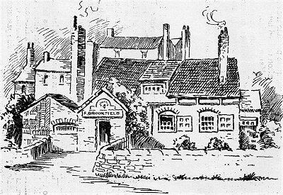
The engravings of Park Road Windmill, The South Shore and the Tall house are from the wonderful resource Ancestry Images, in turn sourced from Pictorial Relics of Ancient Liverpool, engraved by W.G. Herdman, 1843. The picture of the Herculaneum Pottery is from Yo! Liverpool. John Cragg's House, the Priory and Priory and the Grange are from The Priory and the Cast Iron Shore. The drawing of the Waterfall on the Osklesbrok are from Mike Royden's invaluable Local History Pages. The original design for the synagogue is from The Liverpolitan. My thanks to all of the these. The drawings of Knott's Hole and Dickenson's Dingle are from A History of the Royal and Ancient Park of Toxteth by R. Griffiths. The drawings of the Old Peacock Inn, John Cragg's House, Mather's Dam and the Mersey Forge are from Griffiths.
This is a non-commercial website that is intended entirely for research and educational purposes. If I have unintentionally breached copyright with any images, I hope that the copyright owner will tolerate my usage in the present context, otherwise I will remove the material. Modern colour photographs are by the author.