 |
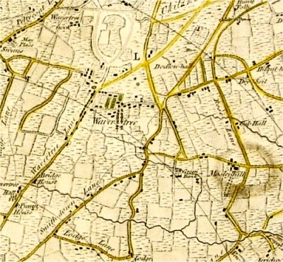
| Wavertree
on the Yates and Perry Map of 1768 |
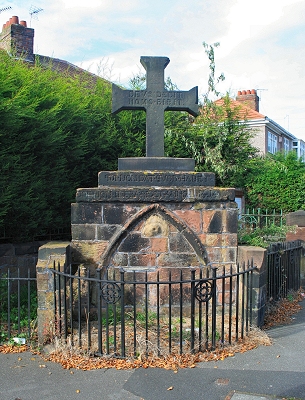 |
| The
Monk's Well |
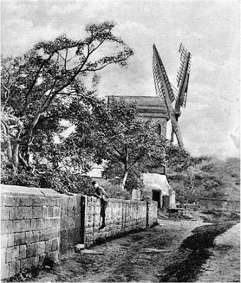 |
| Wavertree
Mill in 1905 |
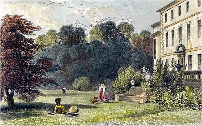 |
| Wavertree
Hall c.1800 |
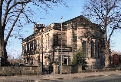 |
| Holy
Trinity Church |
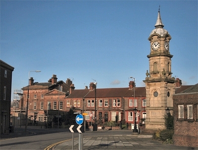 |
| Wavertree
Clock Tower |
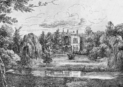 |
| Green
Bank c.1815 |
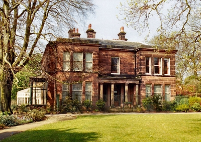 |
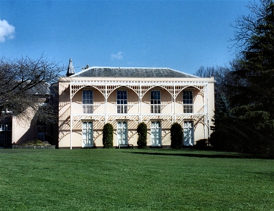
| Sudley
House |
|
| A Brief History
of Wavertree |
| Wavertree
is a fairly large and, on the whole, densely
populated suburban area bounded by the townships
of Everton, West Derby, Childwall, Allerton,
Garston and Toxteth. The parish of Mossley Hill,
which is part of Wavertree, has its own identity
to a certain extent. For much more comprehensive
coverage of Mossley Hill see A History of Allerton and Mossley
Hill. |
| Wavertree
appeared in the Domesday Book of 1086 as Wavretreu
from the
Anglo-Saxon for wavering tree, possibly the alder
tree. |
| The
oldest structure surviving in Wavertree is the
Monks' Well, which may well date from the early
15th century. The base of the cross, added with
the cross itself in the late 19th century, bears
the inscription 'Qui non dat quod habet Doemon
infra ridet' and 'Anno 1414', roughly meaning
'The Devil is laughing down there at him who does
not give what he has'. On the cross itself is the
inscription 'Deus dedit homo bibit' or 'God
gives, man drinks' (I'm thinking of adopting that
for my coat of arms). The whole lies on the site
of a spring where pure water once bubbled out
from the sandstone of Olive Mount. The archway,
now bricked up, once led to steps giving access
to a stone cistern containing water. |
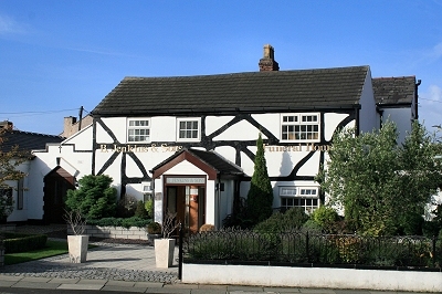
| Also
surviving in Wavertree Village is White Cottage,
which is probably 17th century. By the early 18th century,
Wavertree was still mainly farmland - in 1731
there were only about fifty houses. The village
grew around the junction of what are now High
Street and Church Road North. |
| The
principal landowners by the later 18th century
were Bamber Gascoyne, Thomas Plumbe and Rev.
Thomas Dannett. Gascoyne was an M.P., who
acquired the Manor of Wavertree in the mid-1700s.
There had been a windwill near the village since
the 15th century. This was owned by Gascoyne for
a time and was in intermittent operation until
1890 but was pulled down in 1916 following
irreparable storm damage in 1895. There were
large sandstone quarries on either side, probably
the source of the stone for Holy Trinity Church
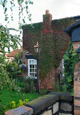
and Wavertree Lock-Up. Nearby Mill Cottages
date from 1730. |
| Wavertree
Hall was located near the southern edge of the
present Wavertree Park (the former Botanical
Gardens) with a lodge on the corner of what are
now Wavertree Road and Botanic Road. The house
was built in 1719 by John Plumbe of the local
landowning family. Lancashire Illustrated
in 1831 informs us that, 'Without much pretension
to architectural elegance, it exhibits a degree
of quiet old-fashioned comfort and sober
antiquity, which is almost peculiar to itself in
the immediate neighbourhood of Liverpool, where
every thing speaks of modern affluence and recent
acquirement.' It was demolished in 1843 following
the arrival nearby of the railway. |
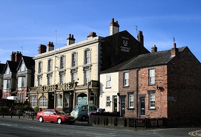
| The Coffee
House is probably
Wavertree's oldest
surviving pub, already listed in 1777 and a
popular venue for day excursions from Liverpool; no doubt some of the
more exuberant trippers ended up in the local
lock-up. By 1900 it was owned by
Liverpool brewer Robert Cain and the sumptuous
interior (much altered since) was his doing. |
| Holy
Trinity Church dates from 1794 and was described
by John Betjeman as 'Liverpool's best Georgian
church'. Its construction marks the arrival of
rich merchants' habitats in the area at this
time. |
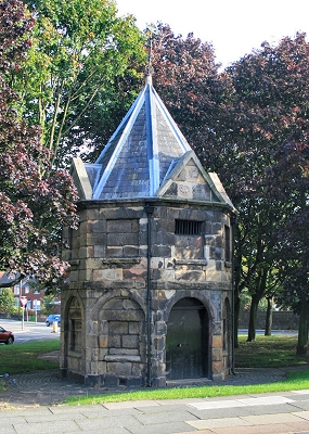
| Wavertree
Lock-Up, a
small sandstone building sometimes known as the Round
House, was built on Wavertree Green in 1796 for
the overnight accommodation of drunks and other
prisoners.
The present pointed roof, complete with
weather-vane, was added in 1869 as part of a
restoration by James Picton, who saved the
lock-up from demolition. After 1845 the new
police station took over its function as a jail,
but it was occasionally used to isolate cholera
victims from the rest of the community. The
triangular village green on which it stands is
the only surviving piece of common land in
Liverpool and the last vestige of the much larger
Wavertree Green, much of which was
enclosed by an Act of Parliament brought by Bamber Gascoyne in 1768. |
| By
the end of the 18th century, rich merchants
already had their eye on the area as a place to
build their villas away from the increasingly
polluted atmosphere of Liverpool. |
| |
[Wavertree's]
proximity to Liverpool, and the salubrity of the
air, have made it the residence of numerous
wealthy families, and the land is fast increasing
in value. The high grounds on the east form a
fine shelter to the lower parts, which include
the Wellington road. [...] In the township is an
extensive brewery, established in 1836, and
subsequently much enlarged by the proprietor, Mr.
John Anderton. [TDE] |
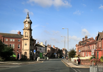
| The
Picton Clock Tower was presented to the people of
Wavertree by architect Sir James Picton in 1884,
having been designed by him as a memorial to his
wife Sarah. He chose the site, at the centre of
the old village, so that the clock could be seen
by as many people as possible. It is described in
the Pevsner Guide as 'an eclectic renaissance
curiosity in brick and stone'. An inscription
reads: 'Time wasted is existence; used is life.' |
| |
The highest
land is in the centre and north, rising to an
elevation of over 200 ft.: the surface slopes
away in the other directions, especially on the
Liverpool side. The old village stood on the
higher part of this westward slope, beside the
road from Liverpool to Woolton, here called High
Street; it has now grown into a town. The eastern
half of the township still retains a rural or
suburban character. [...] The Liverpool tramway
system extends to the top of the High street.
Near the terminus is a small green with a pond,
and close by is Monks' well. [...] Close by is a
clock tower commemorating Sir James Picton, the
Liverpool architect and antiquary, who lived in
Olive Mount. To the east is a piece of ground
which by the terms of the enclosure award must
remain an open space for ever. Near it is the old
windmill. Lower down, towards the railway, is the
fine children's playground presented to Liverpool
by an anonymous benefactor. [VHL] |
| However, as
the end of the 19th century approached, Wavertree
began to merge into Liverpool and there was a
rapid expansion in the population. In 1901 this
stood at 25,303. Parts of the township had
started to lose their appeal: |
| |
Wavertree
[...] is, as it were, one of the arms which, like
other great towns, Liverpool, in the manner of a
vast octopus of bricks and mortar, stretches into
the country along the main roads which lead into
it. At the point where this area of Wavertree
joins on to the body of the city we have the
brick and mortar plague now passing through its
acutest stage [...] streets of cottages awkwardly
fitted in anywhere, or leading into other
streets, which seem in turn to lead nowhere.
There are villainous-looking wastes, whose
surfaces present an alternation of stagnant pools
and hillocks of tipped rubbish, a lonely
public-house or two built as speculations in
'futures' on what may turn out to be 'desirable
corner lots', a grimy brick church, and board
schools [...] but [...] the wastes are slowly and
by degrees disappearing before the enterprise of
the inevitable builder. [from the Liverpool
Daily Post of 1895]. |
|
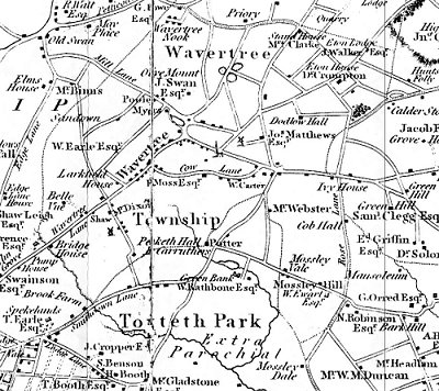 |
| Wavertree
on Sherriff's Map of 1823 |
 |
| White
Cottage |
 |
| Mill
Cottages |
 |
| The
Coffee House |
 |
| Wavertree
Lock-Up |
 |
| Wavertree
Village and High Street |
 |
| Greenbank
House today |
 |
| The
Drawing Room |
|